
S102 Oregon Trail, WY - Earthquake Result Viewer
| ||||||||||||||||||
| ||||||||||||||||||
| ||||||||||||||||||
|
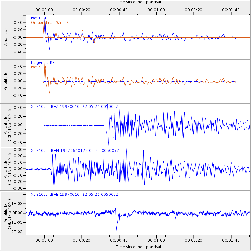
Signal To Noise
| Channel | StoN | STA | LTA |
| XL:S102: :BHN:19970610T22:05:21.005005Z | 7.013185 | 5.7524172E-8 | 8.2022895E-9 |
| XL:S102: :BHE:19970610T22:05:21.005005Z | 1.0524607 | 1.2055959E-10 | 1.1455021E-10 |
| XL:S102: :BHZ:19970610T22:05:21.005005Z | 26.775614 | 1.6894288E-7 | 6.3095804E-9 |
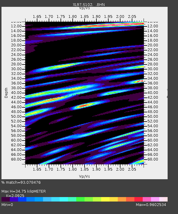
| Arrivals | |
| Ps | 6.3 SECOND |
| PpPs | 17 SECOND |
| PsPs/PpSs | 23 SECOND |

