S102 Oregon Trail, WY - Earthquake Result Viewer
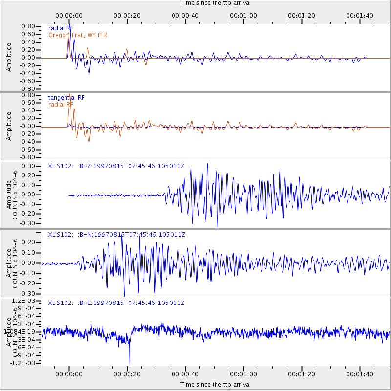
Earthquake location: Central East Pacific Rise
Earthquake latitude/longitude: -4.4/-105.7
Earthquake time(UTC): 1997/08/15 (227) 07:37:49 GMT
Earthquake Depth: 10 km
Earthquake Magnitude: 5.3 MB, 5.8 MS, 6.2 UNKNOWN, 6.1 MW
Earthquake Catalog/Contributor: WHDF/NEIC
Network: XL Deep Probe (Archean-Proterozoic)
Station: S102 Oregon Trail, WY
Lat/Lon: 42.34 N/108.94 W
Elevation: 2212 m
Distance: 46.6 deg
Az: 356.695 deg
Baz: 175.553 deg
Ray Param: 0.07055074
Estimated Moho Depth: 10.5 km
Estimated Crust Vp/Vs: 2.10
Assumed Crust Vp: 6.161 km/s
Estimated Crust Vs: 2.937 km/s
Estimated Crust Poisson's Ratio: 0.35
Radial Match: 88.351395 %
Radial Bump: 400
Transverse Match: 88.18709 %
Transverse Bump: 400
SOD ConfigId: 6273
Insert Time: 2010-03-08 18:17:42.142 +0000
GWidth: 2.5
Max Bumps: 400
Tol: 0.001

Signal To Noise

ChannelStoNSTALTA
XL:S102: :BHN:19970815T07:45:46.105011Z3.90649342.458304E-86.292866E-9
XL:S102: :BHE:19970815T07:45:46.105011Z1.00684831.1190738E-101.1114622E-10
XL:S102: :BHZ:19970815T07:45:46.105011Z6.2331763.494486E-85.6062692E-9
Arrivals
Ps2.0 SECOND
PpPs5.0 SECOND
PsPs/PpSs7.0 SECOND