You are here: Home > Network List > G - GEOSCOPE Stations List
> Station INU Inuyama, Japan > Earthquake Result Viewer
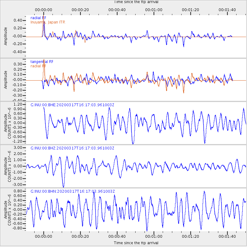
INU Inuyama, Japan - Earthquake Result Viewer
*The percent match for this event was below the threshold and hence no stack was calculated.
| Earthquake location: |
Samoa Islands Region |
| Earthquake latitude/longitude: |
-16.0/-172.2 |
| Earthquake time(UTC): |
2020/03/17 (077) 16:06:22 GMT |
| Earthquake Depth: |
10 km |
| Earthquake Magnitude: |
6.0 mww |
| Earthquake Catalog/Contributor: |
NEIC PDE/us |
|
| Network: |
G GEOSCOPE |
| Station: |
INU Inuyama, Japan |
| Lat/Lon: |
35.35 N/137.03 E |
| Elevation: |
132 m |
|
| Distance: |
70.2 deg |
| Az: |
317.688 deg |
| Baz: |
127.637 deg |
| Ray Param: |
$rayparam |
*The percent match for this event was below the threshold and hence was not used in the summary stack. |
|
| Radial Match: |
66.63343 % |
| Radial Bump: |
289 |
| Transverse Match: |
53.187668 % |
| Transverse Bump: |
400 |
| SOD ConfigId: |
20906531 |
| Insert Time: |
2020-04-08 11:21:27.206 +0000 |
| GWidth: |
2.5 |
| Max Bumps: |
400 |
| Tol: |
0.001 |
|
Signal To Noise
| Channel | StoN | STA | LTA |
| G:INU:00:BHZ:20200317T16:17:03.961003Z | 3.3137228 | 7.6174706E-7 | 2.2987652E-7 |
| G:INU:00:BHN:20200317T16:17:03.961003Z | 0.93320036 | 2.6121216E-7 | 2.7991007E-7 |
| G:INU:00:BHE:20200317T16:17:03.961003Z | 1.3258119 | 4.993391E-7 | 3.766289E-7 |
| Arrivals |
| Ps | |
| PpPs | |
| PsPs/PpSs | |


