You are here: Home > Network List > US - United States National Seismic Network Stations List
> Station ELK Elko, Nevada, USA > Earthquake Result Viewer
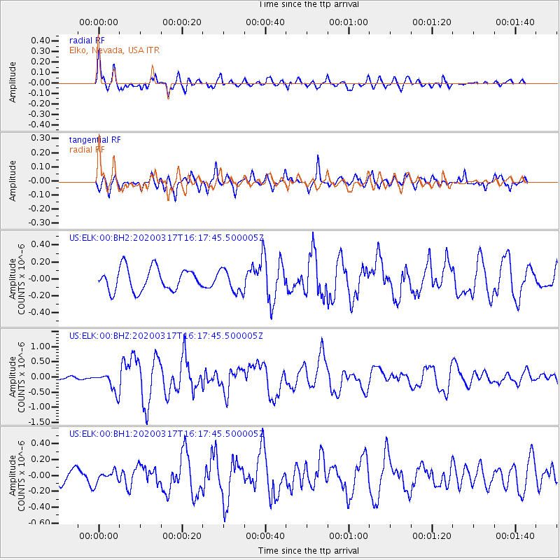
ELK Elko, Nevada, USA - Earthquake Result Viewer
*The percent match for this event was below the threshold and hence no stack was calculated.
| Earthquake location: |
Samoa Islands Region |
| Earthquake latitude/longitude: |
-16.0/-172.2 |
| Earthquake time(UTC): |
2020/03/17 (077) 16:06:22 GMT |
| Earthquake Depth: |
10 km |
| Earthquake Magnitude: |
6.0 mww |
| Earthquake Catalog/Contributor: |
NEIC PDE/us |
|
| Network: |
US United States National Seismic Network |
| Station: |
ELK Elko, Nevada, USA |
| Lat/Lon: |
40.74 N/115.24 W |
| Elevation: |
2210 m |
|
| Distance: |
77.3 deg |
| Az: |
40.758 deg |
| Baz: |
235.722 deg |
| Ray Param: |
$rayparam |
*The percent match for this event was below the threshold and hence was not used in the summary stack. |
|
| Radial Match: |
75.32636 % |
| Radial Bump: |
400 |
| Transverse Match: |
74.19331 % |
| Transverse Bump: |
400 |
| SOD ConfigId: |
20906531 |
| Insert Time: |
2020-04-08 11:31:51.654 +0000 |
| GWidth: |
2.5 |
| Max Bumps: |
400 |
| Tol: |
0.001 |
|
Signal To Noise
| Channel | StoN | STA | LTA |
| US:ELK:00:BHZ:20200317T16:17:45.500005Z | 1.5169021 | 3.3724965E-7 | 2.223279E-7 |
| US:ELK:00:BH1:20200317T16:17:45.500005Z | 0.5242898 | 6.4444116E-8 | 1.2291697E-7 |
| US:ELK:00:BH2:20200317T16:17:45.500005Z | 1.0302607 | 1.358517E-7 | 1.3186148E-7 |
| Arrivals |
| Ps | |
| PpPs | |
| PsPs/PpSs | |


