You are here: Home > Network List > AV - Alaska Volcano Observatory Stations List
> Station PLBL Mt. Peulik Volcano, Alaska > Earthquake Result Viewer
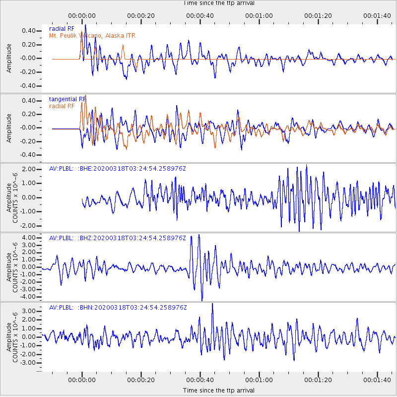
PLBL Mt. Peulik Volcano, Alaska - Earthquake Result Viewer
*The percent match for this event was below the threshold and hence no stack was calculated.
| Earthquake location: |
North Of Halmahera, Indonesia |
| Earthquake latitude/longitude: |
3.0/128.0 |
| Earthquake time(UTC): |
2020/03/18 (078) 03:13:29 GMT |
| Earthquake Depth: |
102 km |
| Earthquake Magnitude: |
5.4 Mww |
| Earthquake Catalog/Contributor: |
NEIC PDE/us |
|
| Network: |
AV Alaska Volcano Observatory |
| Station: |
PLBL Mt. Peulik Volcano, Alaska |
| Lat/Lon: |
57.70 N/156.82 W |
| Elevation: |
461 m |
|
| Distance: |
79.5 deg |
| Az: |
31.854 deg |
| Baz: |
258.981 deg |
| Ray Param: |
$rayparam |
*The percent match for this event was below the threshold and hence was not used in the summary stack. |
|
| Radial Match: |
70.68614 % |
| Radial Bump: |
400 |
| Transverse Match: |
72.77231 % |
| Transverse Bump: |
400 |
| SOD ConfigId: |
20906531 |
| Insert Time: |
2020-04-08 11:37:39.150 +0000 |
| GWidth: |
2.5 |
| Max Bumps: |
400 |
| Tol: |
0.001 |
|
Signal To Noise
| Channel | StoN | STA | LTA |
| AV:PLBL: :BHZ:20200318T03:24:54.258976Z | 1.7604436 | 8.922241E-7 | 5.0681774E-7 |
| AV:PLBL: :BHN:20200318T03:24:54.258976Z | 1.70869 | 7.209278E-7 | 4.2191843E-7 |
| AV:PLBL: :BHE:20200318T03:24:54.258976Z | 1.6552098 | 7.308692E-7 | 4.4155684E-7 |
| Arrivals |
| Ps | |
| PpPs | |
| PsPs/PpSs | |


