S107 Black Butte - Earthquake Result Viewer
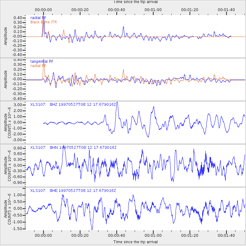
Earthquake location: Tonga Islands
Earthquake latitude/longitude: -15.2/-173.3
Earthquake time(UTC): 1997/05/27 (147) 08:00:29 GMT
Earthquake Depth: 14 km
Earthquake Magnitude: 5.6 MB, 6.3 MS, 6.4 UNKNOWN, 5.7 ME
Earthquake Catalog/Contributor: WHDF/NEIC
Network: XL Deep Probe (Archean-Proterozoic)
Station: S107 Black Butte
Lat/Lon: 41.90 N/108.84 W
Elevation: 2103 m
Distance: 82.1 deg
Az: 42.85 deg
Baz: 241.585 deg
Ray Param: 0.047094297
Estimated Moho Depth: 40.5 km
Estimated Crust Vp/Vs: 1.73
Assumed Crust Vp: 6.207 km/s
Estimated Crust Vs: 3.583 km/s
Estimated Crust Poisson's Ratio: 0.25
Radial Match: 80.15339 %
Radial Bump: 400
Transverse Match: 67.00524 %
Transverse Bump: 400
SOD ConfigId: 6273
Insert Time: 2010-03-08 18:18:41.351 +0000
GWidth: 2.5
Max Bumps: 400
Tol: 0.001

Signal To Noise

ChannelStoNSTALTA
XL:S107: :BHN:19970527T08:12:17.679016Z1.04748772.4660017E-72.3542057E-7
XL:S107: :BHE:19970527T08:12:17.679016Z1.37961092.8623305E-72.0747375E-7
XL:S107: :BHZ:19970527T08:12:17.679016Z3.97874985.052207E-71.2697977E-7
Arrivals
Ps4.9 SECOND
PpPs17 SECOND
PsPs/PpSs22 SECOND