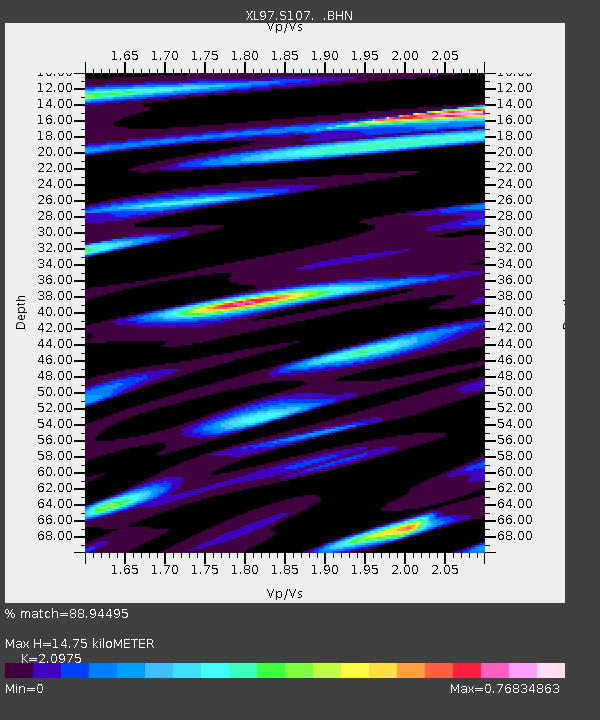
S107 Black Butte - Earthquake Result Viewer
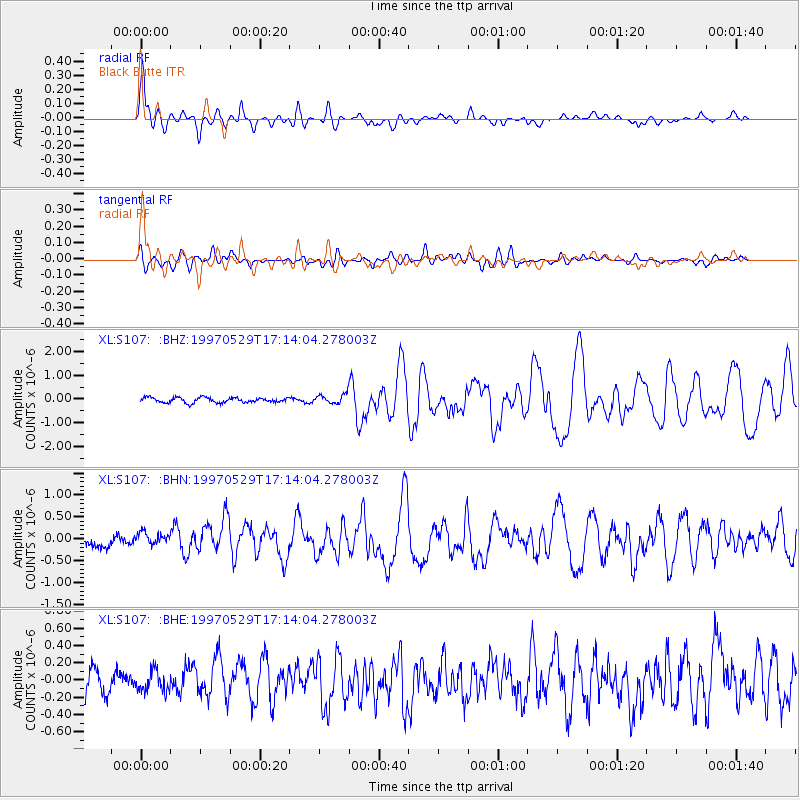
Earthquake location: Southern Pacific Ocean
Earthquake latitude/longitude: -36.0/-102.5
Earthquake time(UTC): 1997/05/29 (149) 17:02:38 GMT
Earthquake Depth: 10 km
Earthquake Magnitude: 5.6 MB, 6.1 MS, 6.5 UNKNOWN, 6.4 MW
Earthquake Catalog/Contributor: WHDF/NEIC
Network: XL Deep Probe (Archean-Proterozoic)
Station: S107 Black Butte
Lat/Lon: 41.90 N/108.84 W
Elevation: 2103 m
Distance: 77.7 deg
Az: 355.165 deg
Baz: 174.744 deg
Ray Param: 0.050136875
Estimated Moho Depth: 14.75 km
Estimated Crust Vp/Vs: 2.10
Assumed Crust Vp: 6.207 km/s
Estimated Crust Vs: 2.959 km/s
Estimated Crust Poisson's Ratio: 0.35
Radial Match: 88.94495 %
Radial Bump: 400
Transverse Match: 63.782005 %
Transverse Bump: 400
SOD ConfigId: 6273
Insert Time: 2010-03-08 18:18:42.187 +0000
GWidth: 2.5
Max Bumps: 400
Tol: 0.001

Signal To Noise

ChannelStoNSTALTA
XL:S107: :BHN:19970529T17:14:04.278003Z1.23285391.5777364E-71.2797432E-7
XL:S107: :BHE:19970529T17:14:04.278003Z0.74829571.1810306E-71.5782939E-7
XL:S107: :BHZ:19970529T17:14:04.278003Z1.59817871.6932161E-71.05946604E-7
Arrivals
Ps2.7 SECOND
PpPs7.2 SECOND
PsPs/PpSs9.9 SECOND