You are here: Home > Network List > TA - USArray Transportable Network (new EarthScope stations) Stations List
> Station M31M Drury Creek, Yukon, CA > Earthquake Result Viewer
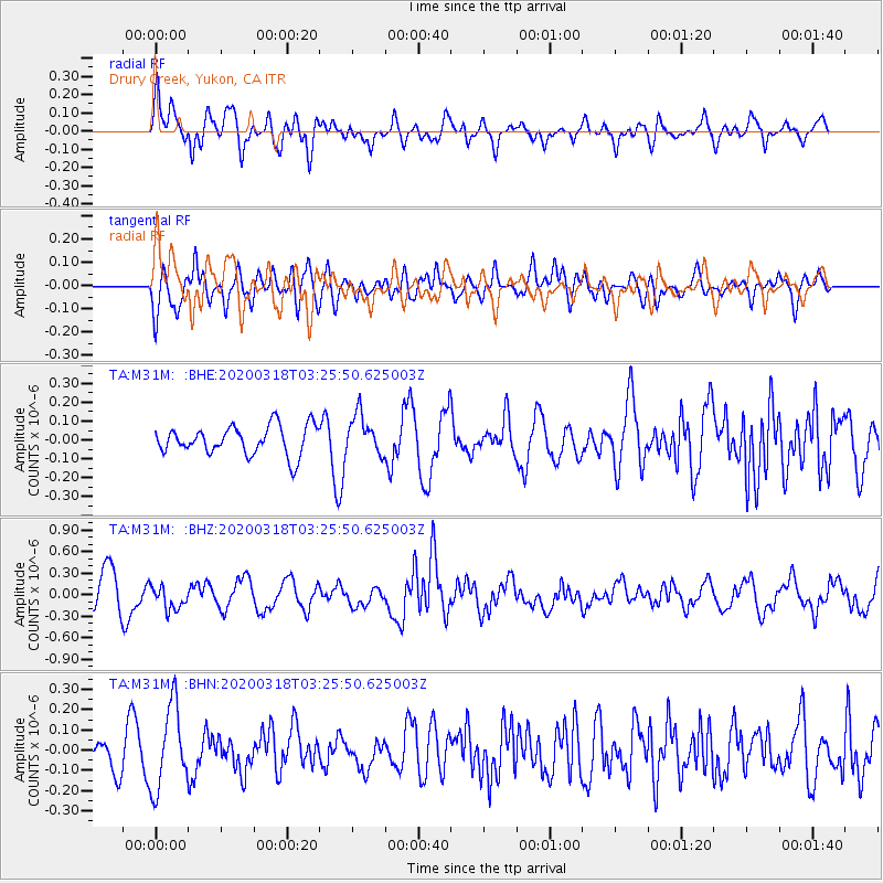
M31M Drury Creek, Yukon, CA - Earthquake Result Viewer
*The percent match for this event was below the threshold and hence no stack was calculated.
| Earthquake location: |
North Of Halmahera, Indonesia |
| Earthquake latitude/longitude: |
3.0/128.0 |
| Earthquake time(UTC): |
2020/03/18 (078) 03:13:29 GMT |
| Earthquake Depth: |
102 km |
| Earthquake Magnitude: |
5.4 Mww |
| Earthquake Catalog/Contributor: |
NEIC PDE/us |
|
| Network: |
TA USArray Transportable Network (new EarthScope stations) |
| Station: |
M31M Drury Creek, Yukon, CA |
| Lat/Lon: |
62.20 N/134.39 W |
| Elevation: |
639 m |
|
| Distance: |
90.9 deg |
| Az: |
27.695 deg |
| Baz: |
278.092 deg |
| Ray Param: |
$rayparam |
*The percent match for this event was below the threshold and hence was not used in the summary stack. |
|
| Radial Match: |
73.115036 % |
| Radial Bump: |
400 |
| Transverse Match: |
62.561546 % |
| Transverse Bump: |
400 |
| SOD ConfigId: |
20906531 |
| Insert Time: |
2020-04-08 11:43:45.405 +0000 |
| GWidth: |
2.5 |
| Max Bumps: |
400 |
| Tol: |
0.001 |
|
Signal To Noise
| Channel | StoN | STA | LTA |
| TA:M31M: :BHZ:20200318T03:25:50.625003Z | 1.0483441 | 1.6985216E-7 | 1.6201946E-7 |
| TA:M31M: :BHN:20200318T03:25:50.625003Z | 2.844802 | 2.041545E-7 | 7.176405E-8 |
| TA:M31M: :BHE:20200318T03:25:50.625003Z | 1.3893834 | 1.05651004E-7 | 7.6041644E-8 |
| Arrivals |
| Ps | |
| PpPs | |
| PsPs/PpSs | |


