S107 Black Butte - Earthquake Result Viewer
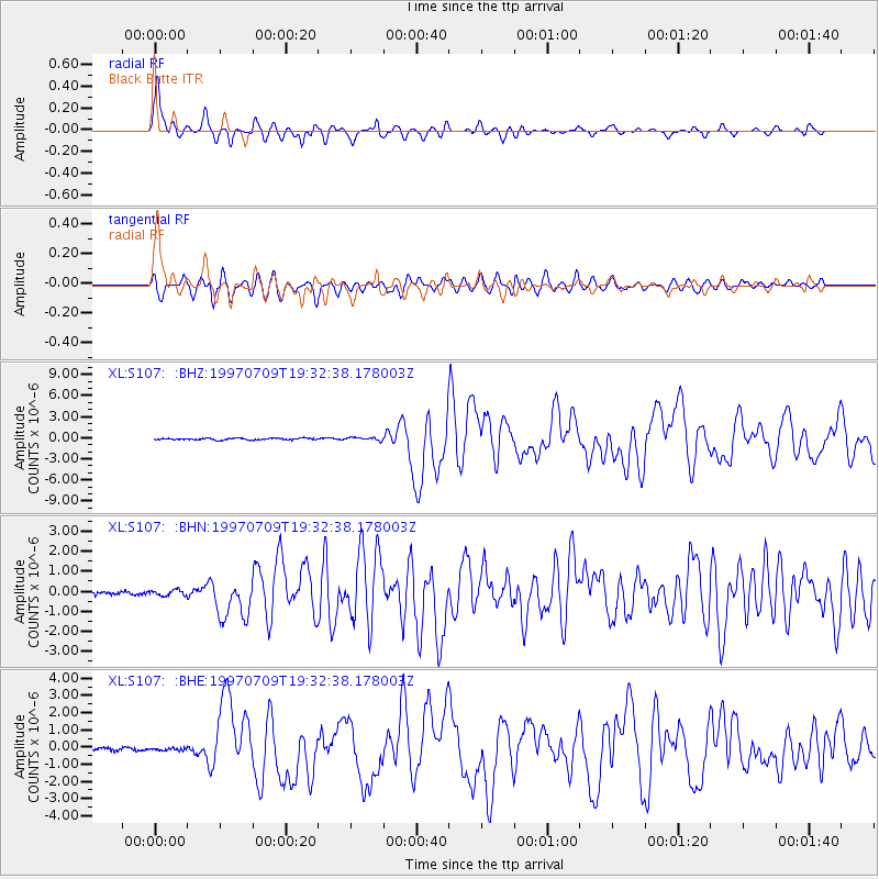
Earthquake location: Near Coast Of Venezuela
Earthquake latitude/longitude: 10.6/-63.5
Earthquake time(UTC): 1997/07/09 (190) 19:24:13 GMT
Earthquake Depth: 20 km
Earthquake Magnitude: 6.2 MB, 6.8 MS, 7.0 UNKNOWN, 6.6 ME
Earthquake Catalog/Contributor: WHDF/NEIC
Network: XL Deep Probe (Archean-Proterozoic)
Station: S107 Black Butte
Lat/Lon: 41.90 N/108.84 W
Elevation: 2103 m
Distance: 50.4 deg
Az: 316.43 deg
Baz: 114.803 deg
Ray Param: 0.06805017
Estimated Moho Depth: 67.0 km
Estimated Crust Vp/Vs: 1.68
Assumed Crust Vp: 6.207 km/s
Estimated Crust Vs: 3.689 km/s
Estimated Crust Poisson's Ratio: 0.23
Radial Match: 92.540886 %
Radial Bump: 400
Transverse Match: 81.93904 %
Transverse Bump: 400
SOD ConfigId: 6273
Insert Time: 2010-03-08 18:18:46.476 +0000
GWidth: 2.5
Max Bumps: 400
Tol: 0.001

Signal To Noise

ChannelStoNSTALTA
XL:S107: :BHN:19970709T19:32:38.178003Z1.09527351.4590628E-71.3321447E-7
XL:S107: :BHE:19970709T19:32:38.178003Z0.82227337.406069E-89.006821E-8
XL:S107: :BHZ:19970709T19:32:38.178003Z1.74567642.1140332E-71.211011E-7
Arrivals
Ps7.8 SECOND
PpPs27 SECOND
PsPs/PpSs35 SECOND