You are here: Home > Network List > US - United States National Seismic Network Stations List
> Station DGMT Dagmar, Montana, USA > Earthquake Result Viewer
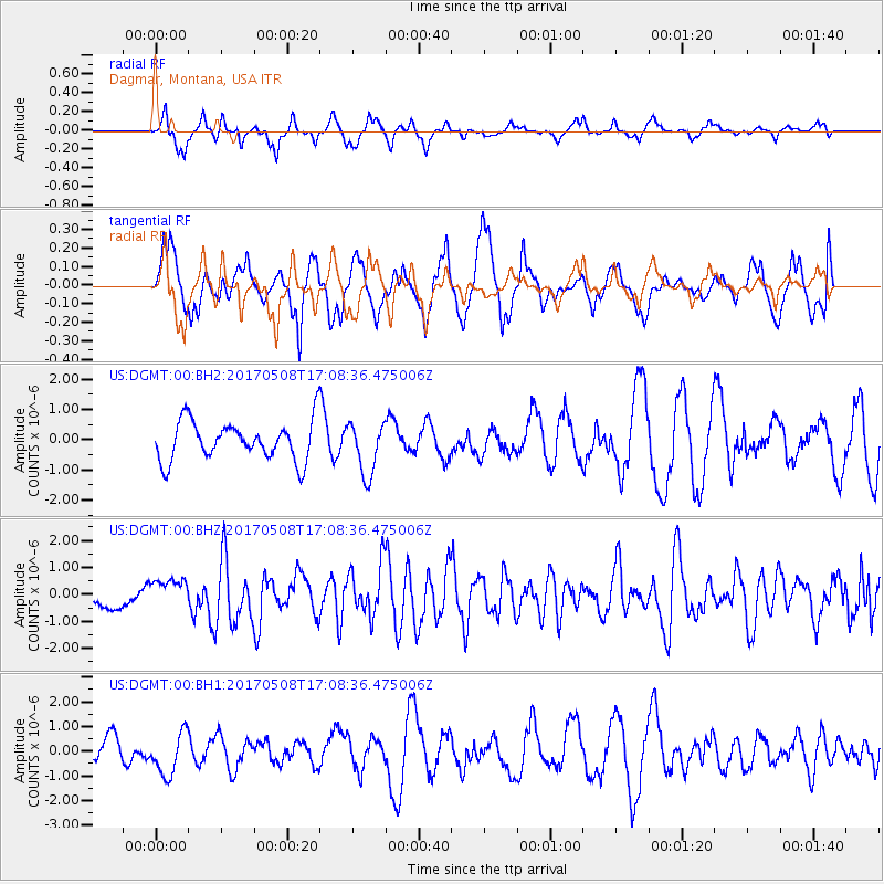
DGMT Dagmar, Montana, USA - Earthquake Result Viewer
*The percent match for this event was below the threshold and hence no stack was calculated.
| Earthquake location: |
Andreanof Islands, Aleutian Is. |
| Earthquake latitude/longitude: |
51.4/-178.6 |
| Earthquake time(UTC): |
2017/05/08 (128) 17:00:42 GMT |
| Earthquake Depth: |
1.0 km |
| Earthquake Magnitude: |
6.6 Mi |
| Earthquake Catalog/Contributor: |
NEIC PDE/at |
|
| Network: |
US United States National Seismic Network |
| Station: |
DGMT Dagmar, Montana, USA |
| Lat/Lon: |
48.47 N/104.20 W |
| Elevation: |
0.0 m |
|
| Distance: |
46.1 deg |
| Az: |
62.861 deg |
| Baz: |
303.014 deg |
| Ray Param: |
$rayparam |
*The percent match for this event was below the threshold and hence was not used in the summary stack. |
|
| Radial Match: |
48.366856 % |
| Radial Bump: |
326 |
| Transverse Match: |
59.661602 % |
| Transverse Bump: |
400 |
| SOD ConfigId: |
2028011 |
| Insert Time: |
2017-05-22 17:04:55.763 +0000 |
| GWidth: |
2.5 |
| Max Bumps: |
400 |
| Tol: |
0.001 |
|
Signal To Noise
| Channel | StoN | STA | LTA |
| US:DGMT:00:BHZ:20170508T17:08:36.475006Z | 1.4140972 | 5.491323E-7 | 3.8832715E-7 |
| US:DGMT:00:BH1:20170508T17:08:36.475006Z | 1.84256 | 8.9163103E-7 | 4.8390876E-7 |
| US:DGMT:00:BH2:20170508T17:08:36.475006Z | 1.3266957 | 8.6140204E-7 | 6.492838E-7 |
| Arrivals |
| Ps | |
| PpPs | |
| PsPs/PpSs | |


