You are here: Home > Network List > TS - TERRAscope (Southern California Seismic Network) Stations List
> Station PFO Pinon Flat, California, USA > Earthquake Result Viewer
PFO Pinon Flat, California, USA - Earthquake Result Viewer
*The percent match for this event was below the threshold and hence no stack was calculated.
| Earthquake location: |
Kuril Islands |
| Earthquake latitude/longitude: |
50.8/157.4 |
| Earthquake time(UTC): |
1995/09/30 (273) 10:47:56 GMT |
| Earthquake Depth: |
33 km |
| Earthquake Magnitude: |
5.7 MB, 5.5 MS |
| Earthquake Catalog/Contributor: |
WHDF/NEIC |
|
| Network: |
TS TERRAscope (Southern California Seismic Network) |
| Station: |
PFO Pinon Flat, California, USA |
| Lat/Lon: |
33.61 N/116.46 W |
| Elevation: |
1280 m |
|
| Distance: |
62.5 deg |
| Az: |
69.803 deg |
| Baz: |
314.497 deg |
| Ray Param: |
$rayparam |
*The percent match for this event was below the threshold and hence was not used in the summary stack. |
|
| Radial Match: |
45.631264 % |
| Radial Bump: |
318 |
| Transverse Match: |
49.97207 % |
| Transverse Bump: |
309 |
| SOD ConfigId: |
4480 |
| Insert Time: |
2010-02-26 14:44:24.112 +0000 |
| GWidth: |
2.5 |
| Max Bumps: |
400 |
| Tol: |
0.001 |
|
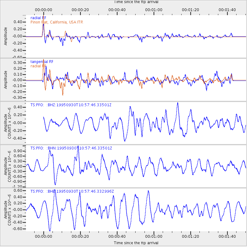
Signal To Noise
| Channel | StoN | STA | LTA |
| TS:PFO: :BHN:19950930T10:57:46.33501Z | 4.3783007 | 4.801516E-7 | 1.096662E-7 |
| TS:PFO: :BHE:19950930T10:57:46.332996Z | 1.4829811 | 3.3982036E-7 | 2.2914679E-7 |
| TS:PFO: :BHZ:19950930T10:57:46.33501Z | 1.2745084 | 1.5278482E-7 | 1.1987746E-7 |
| Arrivals |
| Ps | |
| PpPs | |
| PsPs/PpSs | |


