You are here: Home > Network List > TA - USArray Transportable Network (new EarthScope stations) Stations List
> Station C16K Lisburne Hills, AK, USA > Earthquake Result Viewer
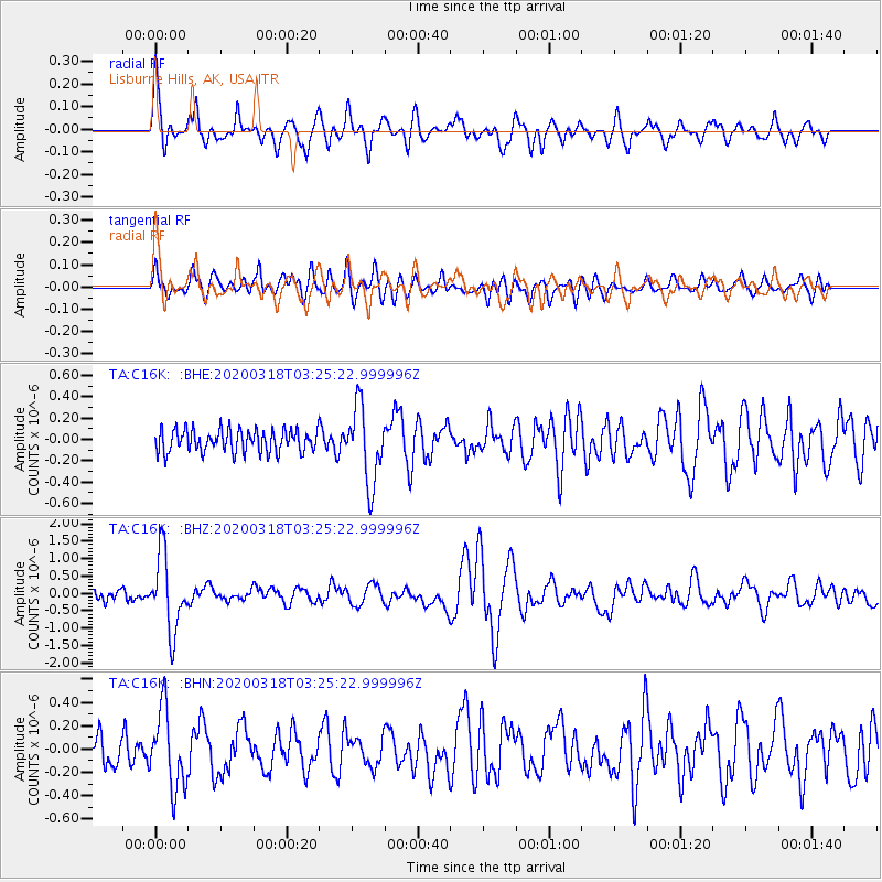
C16K Lisburne Hills, AK, USA - Earthquake Result Viewer
*The percent match for this event was below the threshold and hence no stack was calculated.
| Earthquake location: |
Vanuatu Islands |
| Earthquake latitude/longitude: |
-13.1/167.0 |
| Earthquake time(UTC): |
2020/03/18 (078) 03:13:45 GMT |
| Earthquake Depth: |
176 km |
| Earthquake Magnitude: |
6.1 mww |
| Earthquake Catalog/Contributor: |
NEIC PDE/us |
|
| Network: |
TA USArray Transportable Network (new EarthScope stations) |
| Station: |
C16K Lisburne Hills, AK, USA |
| Lat/Lon: |
68.27 N/165.34 W |
| Elevation: |
102 m |
|
| Distance: |
83.6 deg |
| Az: |
10.005 deg |
| Baz: |
207.04 deg |
| Ray Param: |
$rayparam |
*The percent match for this event was below the threshold and hence was not used in the summary stack. |
|
| Radial Match: |
77.78443 % |
| Radial Bump: |
400 |
| Transverse Match: |
80.70811 % |
| Transverse Bump: |
400 |
| SOD ConfigId: |
20906531 |
| Insert Time: |
2020-04-08 11:59:53.536 +0000 |
| GWidth: |
2.5 |
| Max Bumps: |
400 |
| Tol: |
0.001 |
|
Signal To Noise
| Channel | StoN | STA | LTA |
| TA:C16K: :BHZ:20200318T03:25:22.999996Z | 6.2949524 | 1.0780062E-6 | 1.7124931E-7 |
| TA:C16K: :BHN:20200318T03:25:22.999996Z | 2.1349576 | 3.3126744E-7 | 1.5516348E-7 |
| TA:C16K: :BHE:20200318T03:25:22.999996Z | 3.420112 | 3.5780536E-7 | 1.0461803E-7 |
| Arrivals |
| Ps | |
| PpPs | |
| PsPs/PpSs | |


