You are here: Home > Network List > TA - USArray Transportable Network (new EarthScope stations) Stations List
> Station L15K Ungalak Mountain, AK, USA > Earthquake Result Viewer
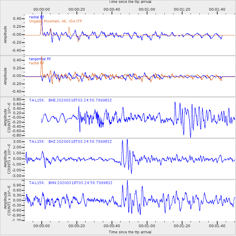
L15K Ungalak Mountain, AK, USA - Earthquake Result Viewer
*The percent match for this event was below the threshold and hence no stack was calculated.
| Earthquake location: |
Vanuatu Islands |
| Earthquake latitude/longitude: |
-13.1/167.0 |
| Earthquake time(UTC): |
2020/03/18 (078) 03:13:45 GMT |
| Earthquake Depth: |
176 km |
| Earthquake Magnitude: |
6.1 mww |
| Earthquake Catalog/Contributor: |
NEIC PDE/us |
|
| Network: |
TA USArray Transportable Network (new EarthScope stations) |
| Station: |
L15K Ungalak Mountain, AK, USA |
| Lat/Lon: |
61.68 N/161.49 W |
| Elevation: |
219 m |
|
| Distance: |
78.6 deg |
| Az: |
14.72 deg |
| Baz: |
211.267 deg |
| Ray Param: |
$rayparam |
*The percent match for this event was below the threshold and hence was not used in the summary stack. |
|
| Radial Match: |
76.6097 % |
| Radial Bump: |
400 |
| Transverse Match: |
71.57709 % |
| Transverse Bump: |
399 |
| SOD ConfigId: |
20906531 |
| Insert Time: |
2020-04-08 12:01:40.254 +0000 |
| GWidth: |
2.5 |
| Max Bumps: |
400 |
| Tol: |
0.001 |
|
Signal To Noise
| Channel | StoN | STA | LTA |
| TA:L15K: :BHZ:20200318T03:24:56.799983Z | 3.2301145 | 6.7480266E-7 | 2.0890984E-7 |
| TA:L15K: :BHN:20200318T03:24:56.799983Z | 1.9014411 | 2.4574166E-7 | 1.292397E-7 |
| TA:L15K: :BHE:20200318T03:24:56.799983Z | 1.5655367 | 2.1130555E-7 | 1.3497323E-7 |
| Arrivals |
| Ps | |
| PpPs | |
| PsPs/PpSs | |


