You are here: Home > Network List > US - United States National Seismic Network Stations List
> Station MSO Missoula, Montana, USA > Earthquake Result Viewer
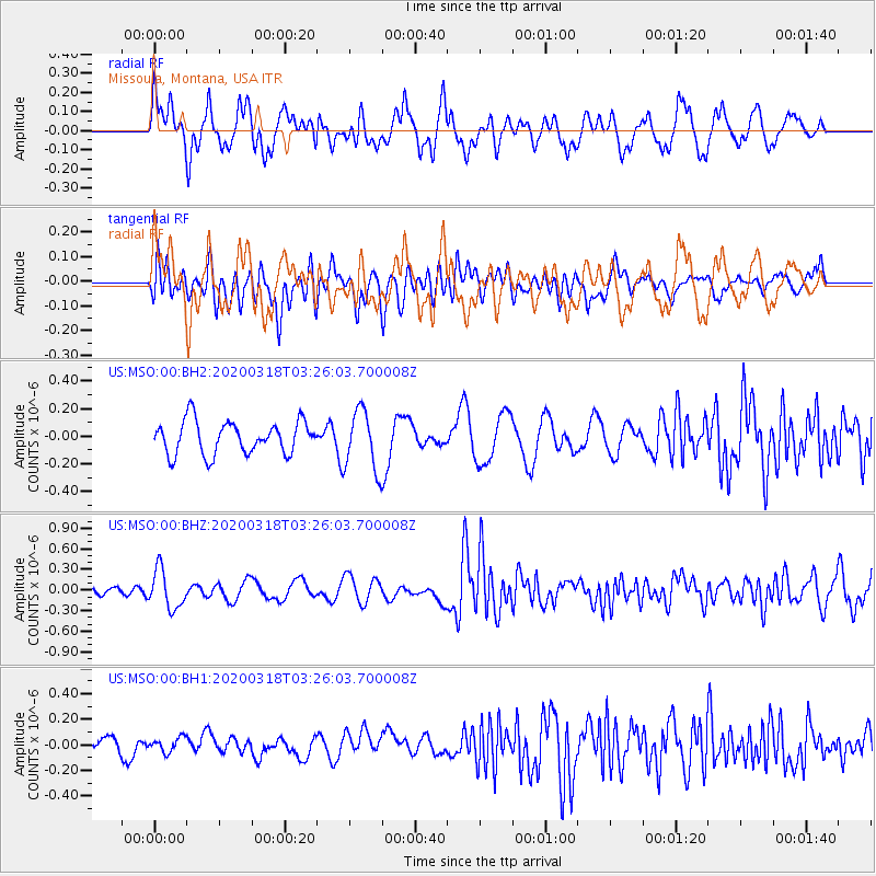
MSO Missoula, Montana, USA - Earthquake Result Viewer
*The percent match for this event was below the threshold and hence no stack was calculated.
| Earthquake location: |
Vanuatu Islands |
| Earthquake latitude/longitude: |
-13.1/167.0 |
| Earthquake time(UTC): |
2020/03/18 (078) 03:13:45 GMT |
| Earthquake Depth: |
176 km |
| Earthquake Magnitude: |
6.1 mww |
| Earthquake Catalog/Contributor: |
NEIC PDE/us |
|
| Network: |
US United States National Seismic Network |
| Station: |
MSO Missoula, Montana, USA |
| Lat/Lon: |
46.83 N/113.94 W |
| Elevation: |
1264 m |
|
| Distance: |
92.1 deg |
| Az: |
42.418 deg |
| Baz: |
253.142 deg |
| Ray Param: |
$rayparam |
*The percent match for this event was below the threshold and hence was not used in the summary stack. |
|
| Radial Match: |
71.03449 % |
| Radial Bump: |
400 |
| Transverse Match: |
64.86113 % |
| Transverse Bump: |
400 |
| SOD ConfigId: |
20906531 |
| Insert Time: |
2020-04-08 12:04:03.720 +0000 |
| GWidth: |
2.5 |
| Max Bumps: |
400 |
| Tol: |
0.001 |
|
Signal To Noise
| Channel | StoN | STA | LTA |
| US:MSO:00:BHZ:20200318T03:26:03.700008Z | 2.3528419 | 2.823073E-7 | 1.1998567E-7 |
| US:MSO:00:BH1:20200318T03:26:03.700008Z | 0.95813835 | 5.6626096E-8 | 5.9100124E-8 |
| US:MSO:00:BH2:20200318T03:26:03.700008Z | 1.832561 | 2.1691925E-7 | 1.1836946E-7 |
| Arrivals |
| Ps | |
| PpPs | |
| PsPs/PpSs | |


