You are here: Home > Network List > TS - TERRAscope (Southern California Seismic Network) Stations List
> Station PFO Pinon Flat, California, USA > Earthquake Result Viewer
PFO Pinon Flat, California, USA - Earthquake Result Viewer
*The percent match for this event was below the threshold and hence no stack was calculated.
| Earthquake location: |
Northern Peru |
| Earthquake latitude/longitude: |
-6.0/-77.1 |
| Earthquake time(UTC): |
1994/01/20 (020) 09:06:52 GMT |
| Earthquake Depth: |
122 km |
| Earthquake Magnitude: |
5.8 MB, 5.7 UNKNOWN |
| Earthquake Catalog/Contributor: |
WHDF/NEIC |
|
| Network: |
TS TERRAscope (Southern California Seismic Network) |
| Station: |
PFO Pinon Flat, California, USA |
| Lat/Lon: |
33.61 N/116.46 W |
| Elevation: |
1280 m |
|
| Distance: |
54.3 deg |
| Az: |
319.3 deg |
| Baz: |
129.004 deg |
| Ray Param: |
$rayparam |
*The percent match for this event was below the threshold and hence was not used in the summary stack. |
|
| Radial Match: |
63.45677 % |
| Radial Bump: |
400 |
| Transverse Match: |
67.557144 % |
| Transverse Bump: |
400 |
| SOD ConfigId: |
4480 |
| Insert Time: |
2010-02-26 14:44:26.764 +0000 |
| GWidth: |
2.5 |
| Max Bumps: |
400 |
| Tol: |
0.001 |
|
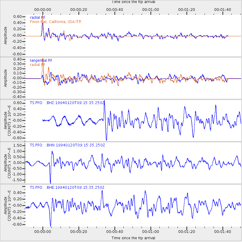
Signal To Noise
| Channel | StoN | STA | LTA |
| TS:PFO: :BHN:19940120T09:15:35.250Z | 3.0758522 | 4.7782396E-7 | 1.5534684E-7 |
| TS:PFO: :BHE:19940120T09:15:35.250Z | 2.031256 | 2.162126E-7 | 1.06442805E-7 |
| TS:PFO: :BHZ:19940120T09:15:35.250Z | 2.0612185 | 2.0357807E-7 | 9.876588E-8 |
| Arrivals |
| Ps | |
| PpPs | |
| PsPs/PpSs | |


