You are here: Home > Network List > TS - TERRAscope (Southern California Seismic Network) Stations List
> Station PFO Pinon Flat, California, USA > Earthquake Result Viewer
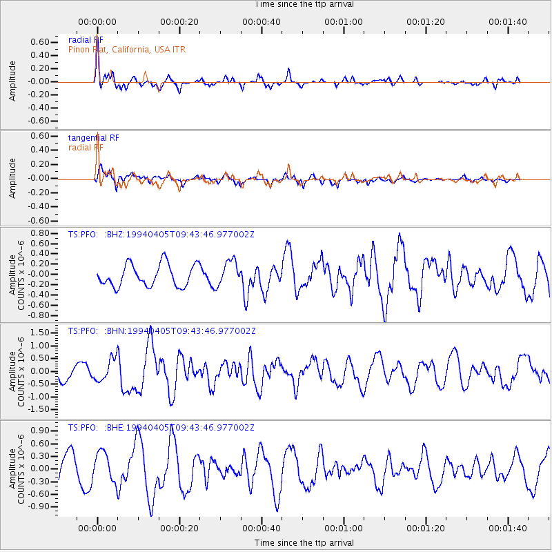
PFO Pinon Flat, California, USA - Earthquake Result Viewer
*The percent match for this event was below the threshold and hence no stack was calculated.
| Earthquake location: |
Andreanof Islands, Aleutian Is. |
| Earthquake latitude/longitude: |
51.3/-178.1 |
| Earthquake time(UTC): |
1994/04/05 (095) 09:35:46 GMT |
| Earthquake Depth: |
33 km |
| Earthquake Magnitude: |
5.8 MB, 5.9 MS, 6.2 UNKNOWN, 6.0 MW |
| Earthquake Catalog/Contributor: |
WHDF/NEIC |
|
| Network: |
TS TERRAscope (Southern California Seismic Network) |
| Station: |
PFO Pinon Flat, California, USA |
| Lat/Lon: |
33.61 N/116.46 W |
| Elevation: |
1280 m |
|
| Distance: |
47.4 deg |
| Az: |
87.072 deg |
| Baz: |
311.302 deg |
| Ray Param: |
$rayparam |
*The percent match for this event was below the threshold and hence was not used in the summary stack. |
|
| Radial Match: |
71.478096 % |
| Radial Bump: |
326 |
| Transverse Match: |
47.31186 % |
| Transverse Bump: |
396 |
| SOD ConfigId: |
4480 |
| Insert Time: |
2010-02-26 14:44:29.298 +0000 |
| GWidth: |
2.5 |
| Max Bumps: |
400 |
| Tol: |
0.001 |
|
Signal To Noise
| Channel | StoN | STA | LTA |
| TS:PFO: :BHN:19940405T09:43:46.977002Z | 1.8425353 | 4.479241E-7 | 2.4310202E-7 |
| TS:PFO: :BHE:19940405T09:43:46.977002Z | 1.1191212 | 3.5806093E-7 | 3.199483E-7 |
| TS:PFO: :BHZ:19940405T09:43:46.977002Z | 1.1484033 | 2.4544968E-7 | 2.1373125E-7 |
| Arrivals |
| Ps | |
| PpPs | |
| PsPs/PpSs | |


