You are here: Home > Network List > TS - TERRAscope (Southern California Seismic Network) Stations List
> Station PFO Pinon Flat, California, USA > Earthquake Result Viewer
PFO Pinon Flat, California, USA - Earthquake Result Viewer
*The percent match for this event was below the threshold and hence no stack was calculated.
| Earthquake location: |
Fiji Islands Region |
| Earthquake latitude/longitude: |
-15.7/-179.3 |
| Earthquake time(UTC): |
1998/01/14 (014) 17:24:10 GMT |
| Earthquake Depth: |
33 km |
| Earthquake Magnitude: |
5.8 MB, 6.5 MS, 6.5 UNKNOWN, 6.5 MW |
| Earthquake Catalog/Contributor: |
WHDF/NEIC |
|
| Network: |
TS TERRAscope (Southern California Seismic Network) |
| Station: |
PFO Pinon Flat, California, USA |
| Lat/Lon: |
33.61 N/116.46 W |
| Elevation: |
1280 m |
|
| Distance: |
77.4 deg |
| Az: |
49.557 deg |
| Baz: |
241.427 deg |
| Ray Param: |
$rayparam |
*The percent match for this event was below the threshold and hence was not used in the summary stack. |
|
| Radial Match: |
70.46154 % |
| Radial Bump: |
400 |
| Transverse Match: |
72.84371 % |
| Transverse Bump: |
400 |
| SOD ConfigId: |
4480 |
| Insert Time: |
2010-02-26 14:44:29.752 +0000 |
| GWidth: |
2.5 |
| Max Bumps: |
400 |
| Tol: |
0.001 |
|
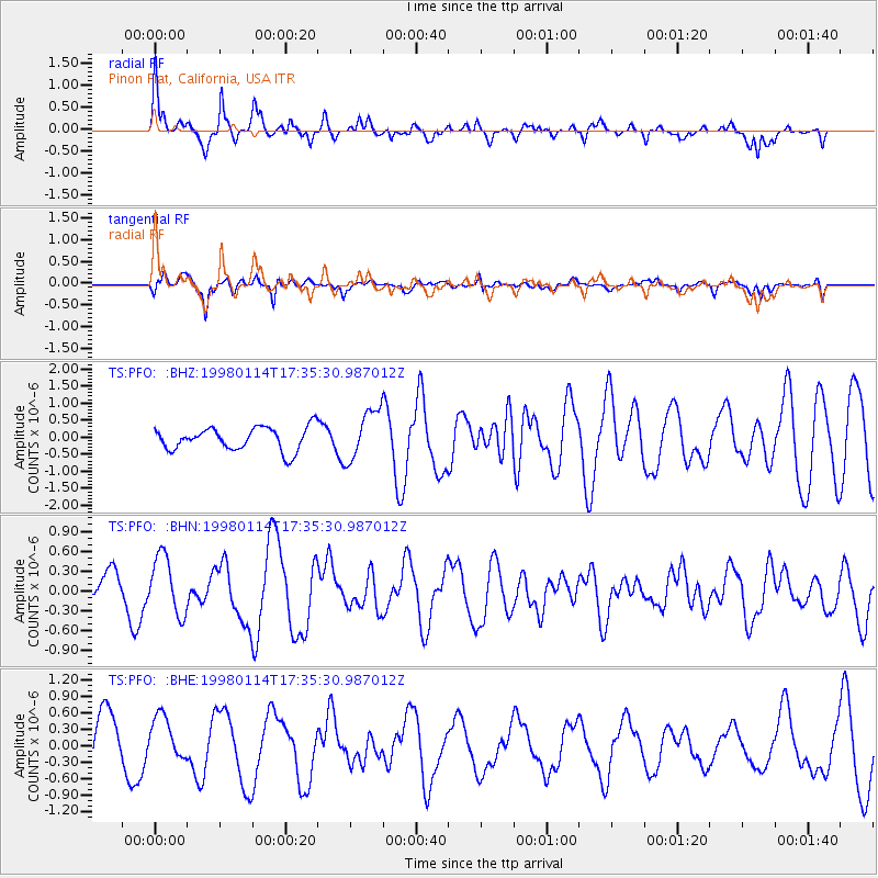
Signal To Noise
| Channel | StoN | STA | LTA |
| TS:PFO: :BHN:19980114T17:35:30.987012Z | 2.0300033 | 4.4086917E-7 | 2.1717659E-7 |
| TS:PFO: :BHE:19980114T17:35:30.987012Z | 0.76245785 | 4.1006248E-7 | 5.3781656E-7 |
| TS:PFO: :BHZ:19980114T17:35:30.987012Z | 2.2079926 | 7.440221E-7 | 3.3696764E-7 |
| Arrivals |
| Ps | |
| PpPs | |
| PsPs/PpSs | |


