You are here: Home > Network List > TS - TERRAscope (Southern California Seismic Network) Stations List
> Station PFO Pinon Flat, California, USA > Earthquake Result Viewer
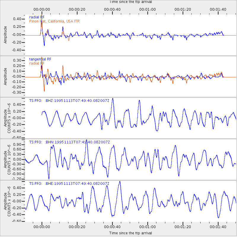
PFO Pinon Flat, California, USA - Earthquake Result Viewer
*The percent match for this event was below the threshold and hence no stack was calculated.
| Earthquake location: |
Tonga Islands |
| Earthquake latitude/longitude: |
-15.1/-173.5 |
| Earthquake time(UTC): |
1995/11/13 (317) 07:38:45 GMT |
| Earthquake Depth: |
33 km |
| Earthquake Magnitude: |
5.7 MB, 5.9 MS, 6.1 UNKNOWN, 6.0 MW |
| Earthquake Catalog/Contributor: |
WHDF/NEIC |
|
| Network: |
TS TERRAscope (Southern California Seismic Network) |
| Station: |
PFO Pinon Flat, California, USA |
| Lat/Lon: |
33.61 N/116.46 W |
| Elevation: |
1280 m |
|
| Distance: |
72.8 deg |
| Az: |
47.146 deg |
| Baz: |
238.048 deg |
| Ray Param: |
$rayparam |
*The percent match for this event was below the threshold and hence was not used in the summary stack. |
|
| Radial Match: |
80.3078 % |
| Radial Bump: |
400 |
| Transverse Match: |
69.064064 % |
| Transverse Bump: |
322 |
| SOD ConfigId: |
4480 |
| Insert Time: |
2010-02-26 14:44:30.509 +0000 |
| GWidth: |
2.5 |
| Max Bumps: |
400 |
| Tol: |
0.001 |
|
Signal To Noise
| Channel | StoN | STA | LTA |
| TS:PFO: :BHN:19951113T07:49:40.082007Z | 3.1399376 | 4.4836207E-7 | 1.4279331E-7 |
| TS:PFO: :BHE:19951113T07:49:40.082007Z | 1.6100501 | 1.5985204E-7 | 9.9283895E-8 |
| TS:PFO: :BHZ:19951113T07:49:40.082007Z | 0.97316784 | 1.3522097E-7 | 1.3894928E-7 |
| Arrivals |
| Ps | |
| PpPs | |
| PsPs/PpSs | |


