You are here: Home > Network List > AV - Alaska Volcano Observatory Stations List
> Station SPCR Ckakachatna River, Mount Spurr, Alaska > Earthquake Result Viewer
SPCR Ckakachatna River, Mount Spurr, Alaska - Earthquake Result Viewer
*The percent match for this event was below the threshold and hence no stack was calculated.
| Earthquake location: |
Utah |
| Earthquake latitude/longitude: |
40.8/-112.1 |
| Earthquake time(UTC): |
2020/03/18 (078) 13:09:31 GMT |
| Earthquake Depth: |
12 km |
| Earthquake Magnitude: |
5.7 mw |
| Earthquake Catalog/Contributor: |
NEIC PDE/uu |
|
| Network: |
AV Alaska Volcano Observatory |
| Station: |
SPCR Ckakachatna River, Mount Spurr, Alaska |
| Lat/Lon: |
61.20 N/152.21 W |
| Elevation: |
984 m |
|
| Distance: |
31.8 deg |
| Az: |
323.64 deg |
| Baz: |
111.546 deg |
| Ray Param: |
$rayparam |
*The percent match for this event was below the threshold and hence was not used in the summary stack. |
|
| Radial Match: |
60.660564 % |
| Radial Bump: |
400 |
| Transverse Match: |
59.027542 % |
| Transverse Bump: |
400 |
| SOD ConfigId: |
20906531 |
| Insert Time: |
2020-04-08 12:23:48.104 +0000 |
| GWidth: |
2.5 |
| Max Bumps: |
400 |
| Tol: |
0.001 |
|
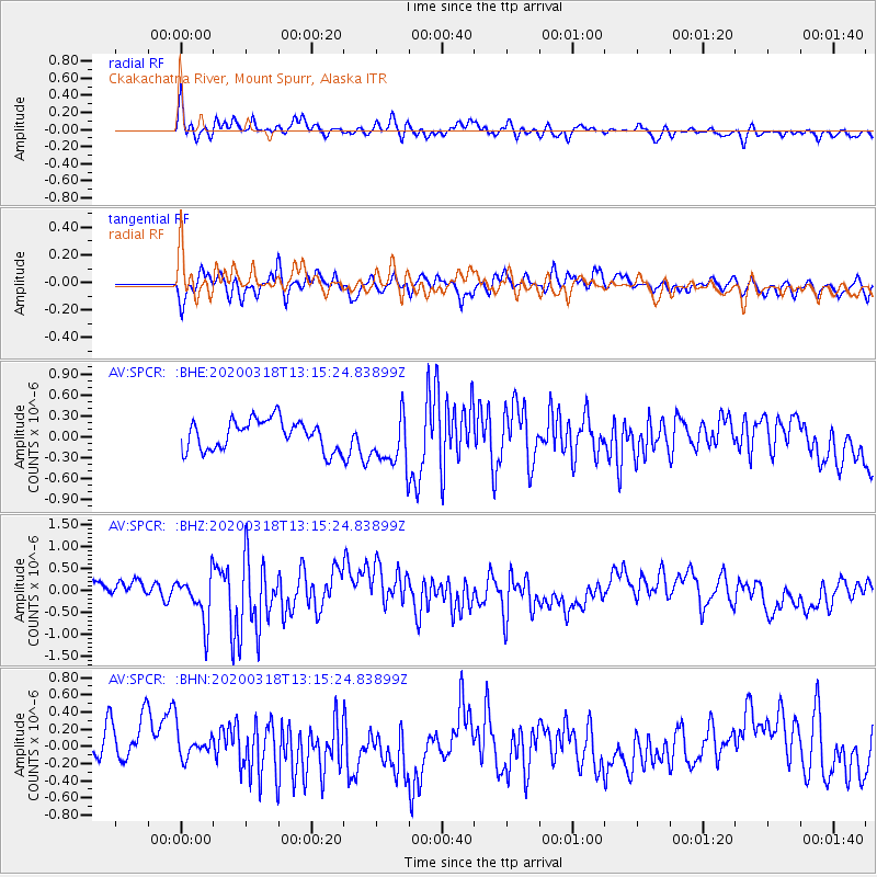
Signal To Noise
| Channel | StoN | STA | LTA |
| AV:SPCR: :BHZ:20200318T13:15:24.83899Z | 2.62079 | 5.352109E-7 | 2.0421739E-7 |
| AV:SPCR: :BHN:20200318T13:15:24.83899Z | 0.64357686 | 1.6342706E-7 | 2.5393558E-7 |
| AV:SPCR: :BHE:20200318T13:15:24.83899Z | 1.7920583 | 3.888156E-7 | 2.1696593E-7 |
| Arrivals |
| Ps | |
| PpPs | |
| PsPs/PpSs | |


