You are here: Home > Network List > TS - TERRAscope (Southern California Seismic Network) Stations List
> Station PFO Pinon Flat, California, USA > Earthquake Result Viewer
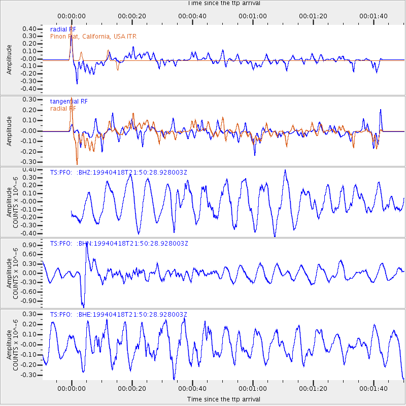
PFO Pinon Flat, California, USA - Earthquake Result Viewer
*The percent match for this event was below the threshold and hence no stack was calculated.
| Earthquake location: |
Fiji Islands Region |
| Earthquake latitude/longitude: |
-21.4/-178.8 |
| Earthquake time(UTC): |
1994/04/18 (108) 21:39:43 GMT |
| Earthquake Depth: |
541 km |
| Earthquake Magnitude: |
5.5 MB |
| Earthquake Catalog/Contributor: |
WHDF/NEIC |
|
| Network: |
TS TERRAscope (Southern California Seismic Network) |
| Station: |
PFO Pinon Flat, California, USA |
| Lat/Lon: |
33.61 N/116.46 W |
| Elevation: |
1280 m |
|
| Distance: |
80.7 deg |
| Az: |
48.52 deg |
| Baz: |
236.797 deg |
| Ray Param: |
$rayparam |
*The percent match for this event was below the threshold and hence was not used in the summary stack. |
|
| Radial Match: |
62.16152 % |
| Radial Bump: |
400 |
| Transverse Match: |
60.240482 % |
| Transverse Bump: |
320 |
| SOD ConfigId: |
4480 |
| Insert Time: |
2010-02-26 14:44:30.981 +0000 |
| GWidth: |
2.5 |
| Max Bumps: |
400 |
| Tol: |
0.001 |
|
Signal To Noise
| Channel | StoN | STA | LTA |
| TS:PFO: :BHN:19940418T21:50:28.928003Z | 2.3089004 | 4.7676753E-7 | 2.0649117E-7 |
| TS:PFO: :BHE:19940418T21:50:28.928003Z | 1.2509545 | 1.2008964E-7 | 9.599841E-8 |
| TS:PFO: :BHZ:19940418T21:50:28.928003Z | 0.9203968 | 1.7588837E-7 | 1.9110058E-7 |
| Arrivals |
| Ps | |
| PpPs | |
| PsPs/PpSs | |


