You are here: Home > Network List > TA - USArray Transportable Network (new EarthScope stations) Stations List
> Station F26K Sheenjek River, AK, USA > Earthquake Result Viewer
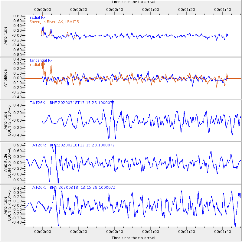
F26K Sheenjek River, AK, USA - Earthquake Result Viewer
*The percent match for this event was below the threshold and hence no stack was calculated.
| Earthquake location: |
Utah |
| Earthquake latitude/longitude: |
40.8/-112.1 |
| Earthquake time(UTC): |
2020/03/18 (078) 13:09:31 GMT |
| Earthquake Depth: |
12 km |
| Earthquake Magnitude: |
5.7 mw |
| Earthquake Catalog/Contributor: |
NEIC PDE/uu |
|
| Network: |
TA USArray Transportable Network (new EarthScope stations) |
| Station: |
F26K Sheenjek River, AK, USA |
| Lat/Lon: |
67.69 N/144.15 W |
| Elevation: |
683 m |
|
| Distance: |
32.1 deg |
| Az: |
337.606 deg |
| Baz: |
130.692 deg |
| Ray Param: |
$rayparam |
*The percent match for this event was below the threshold and hence was not used in the summary stack. |
|
| Radial Match: |
62.82967 % |
| Radial Bump: |
400 |
| Transverse Match: |
69.83653 % |
| Transverse Bump: |
400 |
| SOD ConfigId: |
20906531 |
| Insert Time: |
2020-04-08 12:31:38.113 +0000 |
| GWidth: |
2.5 |
| Max Bumps: |
400 |
| Tol: |
0.001 |
|
Signal To Noise
| Channel | StoN | STA | LTA |
| TA:F26K: :BHZ:20200318T13:15:28.100007Z | 4.2266245 | 3.6373544E-7 | 8.6058144E-8 |
| TA:F26K: :BHN:20200318T13:15:28.100007Z | 1.6386468 | 7.4702044E-8 | 4.5587637E-8 |
| TA:F26K: :BHE:20200318T13:15:28.100007Z | 1.0449736 | 1.16415535E-7 | 1.1140524E-7 |
| Arrivals |
| Ps | |
| PpPs | |
| PsPs/PpSs | |


