You are here: Home > Network List > TA - USArray Transportable Network (new EarthScope stations) Stations List
> Station G16K Koyuk River, AK, USA > Earthquake Result Viewer
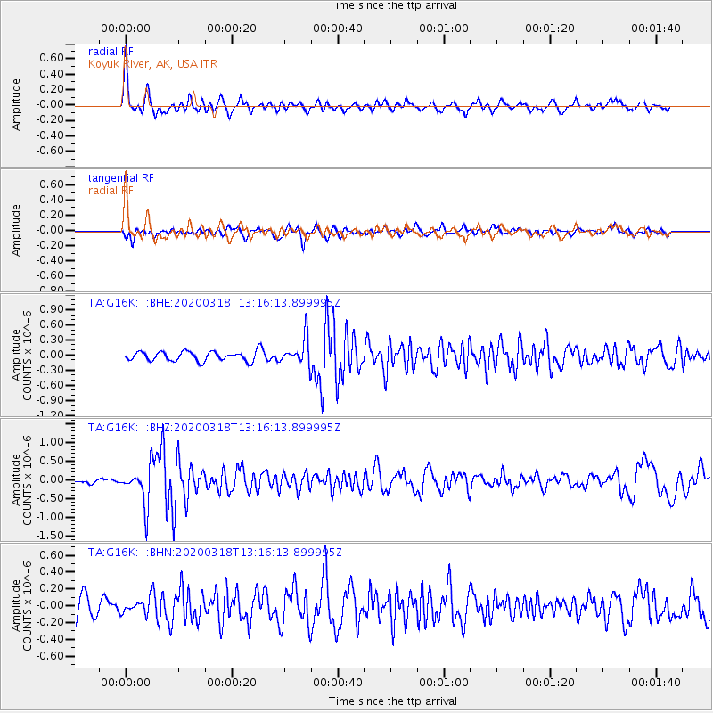
G16K Koyuk River, AK, USA - Earthquake Result Viewer
*The percent match for this event was below the threshold and hence no stack was calculated.
| Earthquake location: |
Utah |
| Earthquake latitude/longitude: |
40.8/-112.1 |
| Earthquake time(UTC): |
2020/03/18 (078) 13:09:31 GMT |
| Earthquake Depth: |
12 km |
| Earthquake Magnitude: |
5.7 mw |
| Earthquake Catalog/Contributor: |
NEIC PDE/uu |
|
| Network: |
TA USArray Transportable Network (new EarthScope stations) |
| Station: |
G16K Koyuk River, AK, USA |
| Lat/Lon: |
65.39 N/162.35 W |
| Elevation: |
169 m |
|
| Distance: |
37.5 deg |
| Az: |
328.028 deg |
| Baz: |
106.1 deg |
| Ray Param: |
$rayparam |
*The percent match for this event was below the threshold and hence was not used in the summary stack. |
|
| Radial Match: |
77.62264 % |
| Radial Bump: |
385 |
| Transverse Match: |
65.98877 % |
| Transverse Bump: |
400 |
| SOD ConfigId: |
20906531 |
| Insert Time: |
2020-04-08 12:31:42.377 +0000 |
| GWidth: |
2.5 |
| Max Bumps: |
400 |
| Tol: |
0.001 |
|
Signal To Noise
| Channel | StoN | STA | LTA |
| TA:G16K: :BHZ:20200318T13:16:13.899995Z | 4.9865403 | 5.0410534E-7 | 1.0109321E-7 |
| TA:G16K: :BHN:20200318T13:16:13.899995Z | 0.64746416 | 8.138991E-8 | 1.2570567E-7 |
| TA:G16K: :BHE:20200318T13:16:13.899995Z | 3.0612013 | 2.6997157E-7 | 8.819138E-8 |
| Arrivals |
| Ps | |
| PpPs | |
| PsPs/PpSs | |


