You are here: Home > Network List > TA - USArray Transportable Network (new EarthScope stations) Stations List
> Station I17K Unalakleet, AK, USA > Earthquake Result Viewer
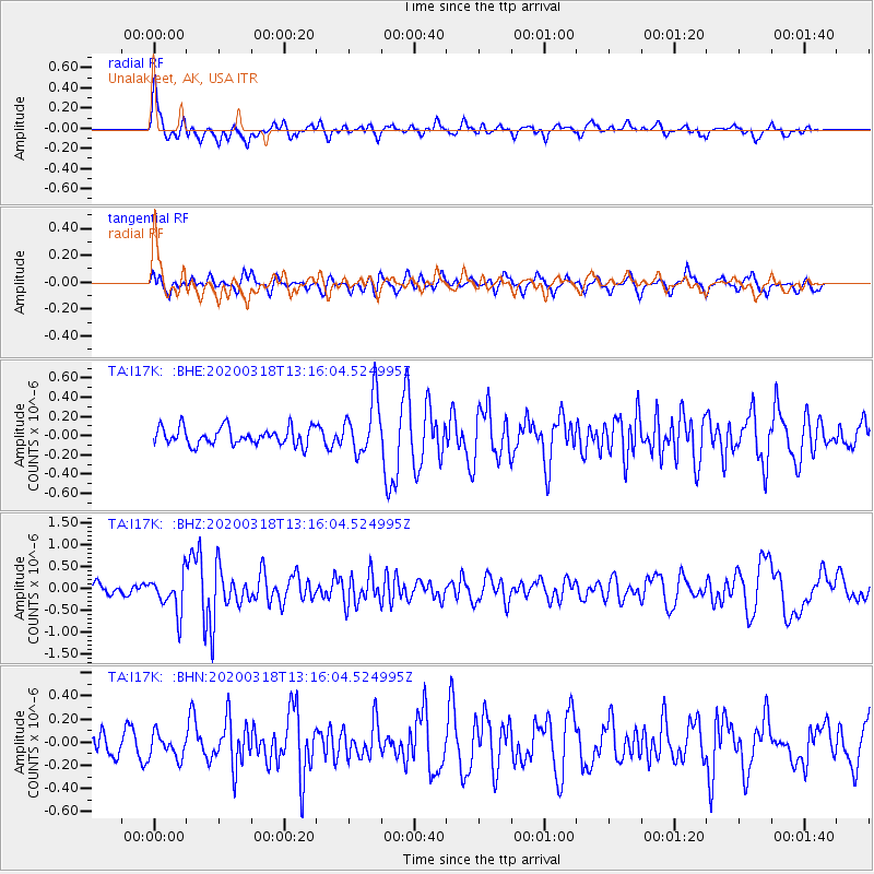
I17K Unalakleet, AK, USA - Earthquake Result Viewer
*The percent match for this event was below the threshold and hence no stack was calculated.
| Earthquake location: |
Utah |
| Earthquake latitude/longitude: |
40.8/-112.1 |
| Earthquake time(UTC): |
2020/03/18 (078) 13:09:31 GMT |
| Earthquake Depth: |
12 km |
| Earthquake Magnitude: |
5.7 mw |
| Earthquake Catalog/Contributor: |
NEIC PDE/uu |
|
| Network: |
TA USArray Transportable Network (new EarthScope stations) |
| Station: |
I17K Unalakleet, AK, USA |
| Lat/Lon: |
63.89 N/160.70 W |
| Elevation: |
105 m |
|
| Distance: |
36.4 deg |
| Az: |
325.933 deg |
| Baz: |
105.923 deg |
| Ray Param: |
$rayparam |
*The percent match for this event was below the threshold and hence was not used in the summary stack. |
|
| Radial Match: |
71.95397 % |
| Radial Bump: |
400 |
| Transverse Match: |
55.682674 % |
| Transverse Bump: |
400 |
| SOD ConfigId: |
20906531 |
| Insert Time: |
2020-04-08 12:32:03.106 +0000 |
| GWidth: |
2.5 |
| Max Bumps: |
400 |
| Tol: |
0.001 |
|
Signal To Noise
| Channel | StoN | STA | LTA |
| TA:I17K: :BHZ:20200318T13:16:04.524995Z | 2.753233 | 4.2663254E-7 | 1.5495694E-7 |
| TA:I17K: :BHN:20200318T13:16:04.524995Z | 0.64300615 | 1.0561878E-7 | 1.6425781E-7 |
| TA:I17K: :BHE:20200318T13:16:04.524995Z | 3.2125535 | 2.9113397E-7 | 9.062384E-8 |
| Arrivals |
| Ps | |
| PpPs | |
| PsPs/PpSs | |


