You are here: Home > Network List > TS - TERRAscope (Southern California Seismic Network) Stations List
> Station PFO Pinon Flat, California, USA > Earthquake Result Viewer
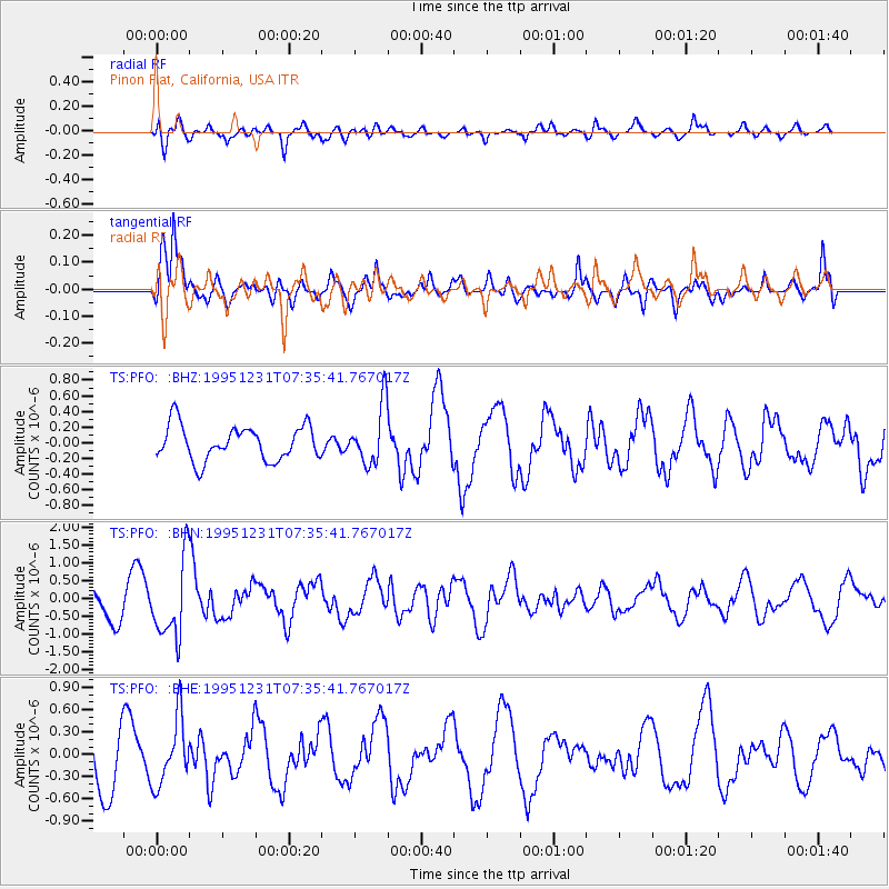
PFO Pinon Flat, California, USA - Earthquake Result Viewer
*The percent match for this event was below the threshold and hence no stack was calculated.
| Earthquake location: |
Near East Coast Of Kamchatka |
| Earthquake latitude/longitude: |
53.9/160.6 |
| Earthquake time(UTC): |
1995/12/31 (365) 07:26:13 GMT |
| Earthquake Depth: |
55 km |
| Earthquake Magnitude: |
6.0 MB, 5.9 UNKNOWN, 5.7 MW |
| Earthquake Catalog/Contributor: |
WHDF/NEIC |
|
| Network: |
TS TERRAscope (Southern California Seismic Network) |
| Station: |
PFO Pinon Flat, California, USA |
| Lat/Lon: |
33.61 N/116.46 W |
| Elevation: |
1280 m |
|
| Distance: |
59.7 deg |
| Az: |
73.619 deg |
| Baz: |
317.102 deg |
| Ray Param: |
$rayparam |
*The percent match for this event was below the threshold and hence was not used in the summary stack. |
|
| Radial Match: |
57.23782 % |
| Radial Bump: |
400 |
| Transverse Match: |
79.604965 % |
| Transverse Bump: |
400 |
| SOD ConfigId: |
4480 |
| Insert Time: |
2010-02-26 14:44:33.688 +0000 |
| GWidth: |
2.5 |
| Max Bumps: |
400 |
| Tol: |
0.001 |
|
Signal To Noise
| Channel | StoN | STA | LTA |
| TS:PFO: :BHN:19951231T07:35:41.767017Z | 1.7406613 | 1.0985867E-6 | 6.3113185E-7 |
| TS:PFO: :BHE:19951231T07:35:41.767017Z | 1.4794855 | 4.4063907E-7 | 2.9783266E-7 |
| TS:PFO: :BHZ:19951231T07:35:41.767017Z | 1.7099285 | 3.760277E-7 | 2.1990843E-7 |
| Arrivals |
| Ps | |
| PpPs | |
| PsPs/PpSs | |


