You are here: Home > Network List > TA - USArray Transportable Network (new EarthScope stations) Stations List
> Station K15K Wolf Creek Mountain, AK, USA > Earthquake Result Viewer
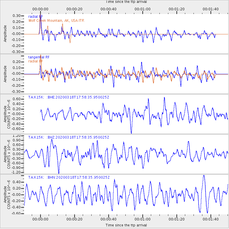
K15K Wolf Creek Mountain, AK, USA - Earthquake Result Viewer
*The percent match for this event was below the threshold and hence no stack was calculated.
| Earthquake location: |
South Of Bali, Indonesia |
| Earthquake latitude/longitude: |
-11.1/115.1 |
| Earthquake time(UTC): |
2020/03/18 (078) 17:45:39 GMT |
| Earthquake Depth: |
20 km |
| Earthquake Magnitude: |
6.2 mww |
| Earthquake Catalog/Contributor: |
NEIC PDE/us |
|
| Network: |
TA USArray Transportable Network (new EarthScope stations) |
| Station: |
K15K Wolf Creek Mountain, AK, USA |
| Lat/Lon: |
62.29 N/161.53 W |
| Elevation: |
346 m |
|
| Distance: |
96.6 deg |
| Az: |
27.861 deg |
| Baz: |
258.974 deg |
| Ray Param: |
$rayparam |
*The percent match for this event was below the threshold and hence was not used in the summary stack. |
|
| Radial Match: |
65.44107 % |
| Radial Bump: |
400 |
| Transverse Match: |
55.57216 % |
| Transverse Bump: |
396 |
| SOD ConfigId: |
20906531 |
| Insert Time: |
2020-04-08 12:39:25.590 +0000 |
| GWidth: |
2.5 |
| Max Bumps: |
400 |
| Tol: |
0.001 |
|
Signal To Noise
| Channel | StoN | STA | LTA |
| TA:K15K: :BHZ:20200318T17:58:35.950025Z | 2.3959837 | 4.154774E-7 | 1.7340575E-7 |
| TA:K15K: :BHN:20200318T17:58:35.950025Z | 0.7414145 | 1.8574723E-7 | 2.505309E-7 |
| TA:K15K: :BHE:20200318T17:58:35.950025Z | 0.6796595 | 8.575374E-8 | 1.2617161E-7 |
| Arrivals |
| Ps | |
| PpPs | |
| PsPs/PpSs | |


