You are here: Home > Network List > TS - TERRAscope (Southern California Seismic Network) Stations List
> Station PFO Pinon Flat, California, USA > Earthquake Result Viewer
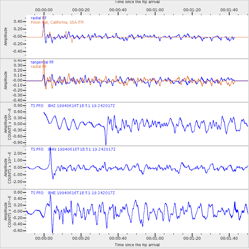
PFO Pinon Flat, California, USA - Earthquake Result Viewer
*The percent match for this event was below the threshold and hence no stack was calculated.
| Earthquake location: |
Southern Peru |
| Earthquake latitude/longitude: |
-15.2/-70.3 |
| Earthquake time(UTC): |
1994/06/16 (167) 18:41:31 GMT |
| Earthquake Depth: |
225 km |
| Earthquake Magnitude: |
5.6 MB, 5.8 UNKNOWN, 6.1 MW |
| Earthquake Catalog/Contributor: |
WHDF/NEIC |
|
| Network: |
TS TERRAscope (Southern California Seismic Network) |
| Station: |
PFO Pinon Flat, California, USA |
| Lat/Lon: |
33.61 N/116.46 W |
| Elevation: |
1280 m |
|
| Distance: |
65.5 deg |
| Az: |
318.614 deg |
| Baz: |
130.101 deg |
| Ray Param: |
$rayparam |
*The percent match for this event was below the threshold and hence was not used in the summary stack. |
|
| Radial Match: |
61.829025 % |
| Radial Bump: |
400 |
| Transverse Match: |
68.01781 % |
| Transverse Bump: |
400 |
| SOD ConfigId: |
4480 |
| Insert Time: |
2010-02-26 14:44:37.019 +0000 |
| GWidth: |
2.5 |
| Max Bumps: |
400 |
| Tol: |
0.001 |
|
Signal To Noise
| Channel | StoN | STA | LTA |
| TS:PFO: :BHN:19940616T18:51:19.242017Z | 6.7385097 | 9.684805E-7 | 1.4372326E-7 |
| TS:PFO: :BHE:19940616T18:51:19.242017Z | 3.5988557 | 2.9159273E-7 | 8.1023735E-8 |
| TS:PFO: :BHZ:19940616T18:51:19.242017Z | 1.9628118 | 3.9391574E-7 | 2.0068951E-7 |
| Arrivals |
| Ps | |
| PpPs | |
| PsPs/PpSs | |


