You are here: Home > Network List > TS - TERRAscope (Southern California Seismic Network) Stations List
> Station PFO Pinon Flat, California, USA > Earthquake Result Viewer
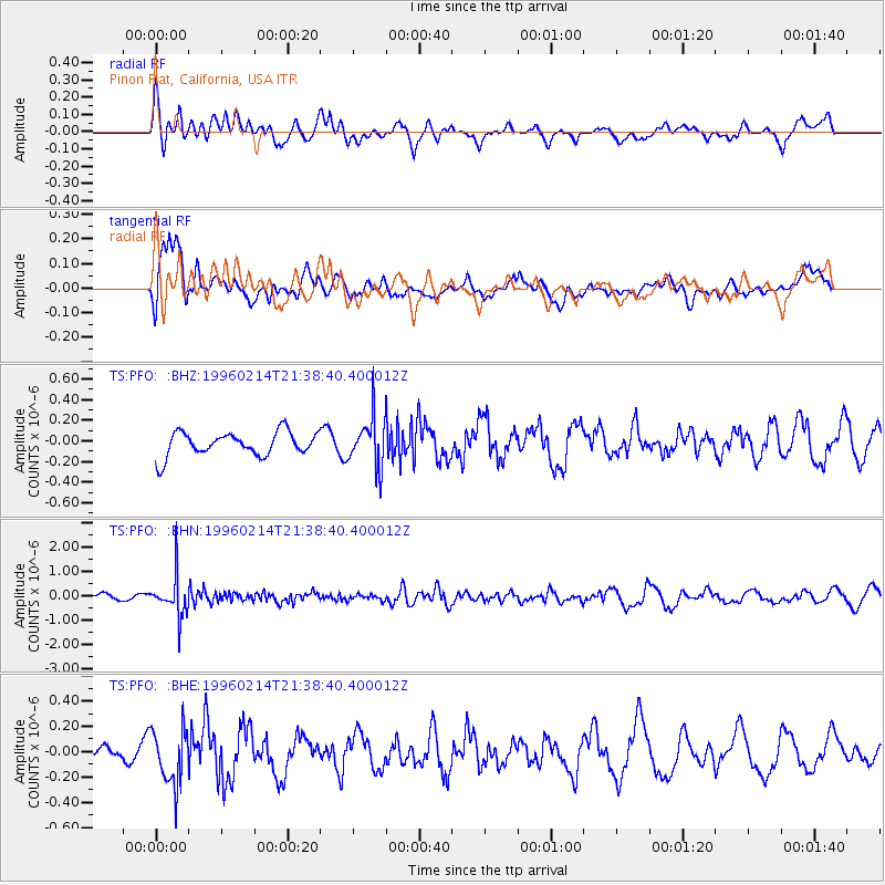
PFO Pinon Flat, California, USA - Earthquake Result Viewer
*The percent match for this event was below the threshold and hence no stack was calculated.
| Earthquake location: |
Southeast Of Honshu, Japan |
| Earthquake latitude/longitude: |
29.2/140.4 |
| Earthquake time(UTC): |
1996/02/14 (045) 21:26:56 GMT |
| Earthquake Depth: |
142 km |
| Earthquake Magnitude: |
5.9 MB |
| Earthquake Catalog/Contributor: |
WHDF/NEIC |
|
| Network: |
TS TERRAscope (Southern California Seismic Network) |
| Station: |
PFO Pinon Flat, California, USA |
| Lat/Lon: |
33.61 N/116.46 W |
| Elevation: |
1280 m |
|
| Distance: |
84.2 deg |
| Az: |
54.769 deg |
| Baz: |
301.174 deg |
| Ray Param: |
$rayparam |
*The percent match for this event was below the threshold and hence was not used in the summary stack. |
|
| Radial Match: |
48.45338 % |
| Radial Bump: |
400 |
| Transverse Match: |
67.8764 % |
| Transverse Bump: |
400 |
| SOD ConfigId: |
4480 |
| Insert Time: |
2010-02-26 14:44:37.434 +0000 |
| GWidth: |
2.5 |
| Max Bumps: |
400 |
| Tol: |
0.001 |
|
Signal To Noise
| Channel | StoN | STA | LTA |
| TS:PFO: :BHN:19960214T21:38:40.400012Z | 3.6270132 | 8.124226E-7 | 2.2399219E-7 |
| TS:PFO: :BHE:19960214T21:38:40.400012Z | 1.7438265 | 2.1648427E-7 | 1.2414323E-7 |
| TS:PFO: :BHZ:19960214T21:38:40.400012Z | 2.0498178 | 2.3533528E-7 | 1.14807904E-7 |
| Arrivals |
| Ps | |
| PpPs | |
| PsPs/PpSs | |


