You are here: Home > Network List > TA - USArray Transportable Network (new EarthScope stations) Stations List
> Station G21K Allakaket, AK, USA > Earthquake Result Viewer
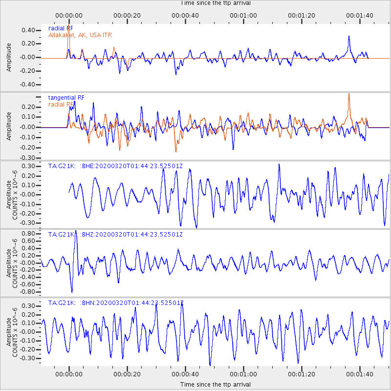
G21K Allakaket, AK, USA - Earthquake Result Viewer
*The percent match for this event was below the threshold and hence no stack was calculated.
| Earthquake location: |
Xizang |
| Earthquake latitude/longitude: |
28.6/87.3 |
| Earthquake time(UTC): |
2020/03/20 (080) 01:33:15 GMT |
| Earthquake Depth: |
10 km |
| Earthquake Magnitude: |
5.7 mww |
| Earthquake Catalog/Contributor: |
NEIC PDE/us |
|
| Network: |
TA USArray Transportable Network (new EarthScope stations) |
| Station: |
G21K Allakaket, AK, USA |
| Lat/Lon: |
66.52 N/153.51 W |
| Elevation: |
446 m |
|
| Distance: |
74.7 deg |
| Az: |
21.278 deg |
| Baz: |
307.231 deg |
| Ray Param: |
$rayparam |
*The percent match for this event was below the threshold and hence was not used in the summary stack. |
|
| Radial Match: |
61.75165 % |
| Radial Bump: |
400 |
| Transverse Match: |
57.814312 % |
| Transverse Bump: |
400 |
| SOD ConfigId: |
20906531 |
| Insert Time: |
2020-04-08 12:53:27.184 +0000 |
| GWidth: |
2.5 |
| Max Bumps: |
400 |
| Tol: |
0.001 |
|
Signal To Noise
| Channel | StoN | STA | LTA |
| TA:G21K: :BHZ:20200320T01:44:23.52501Z | 6.6331058 | 4.320877E-7 | 6.514109E-8 |
| TA:G21K: :BHN:20200320T01:44:23.52501Z | 1.4611007 | 1.3214866E-7 | 9.0444594E-8 |
| TA:G21K: :BHE:20200320T01:44:23.52501Z | 1.347737 | 1.3761677E-7 | 1.0210952E-7 |
| Arrivals |
| Ps | |
| PpPs | |
| PsPs/PpSs | |


