You are here: Home > Network List > GS - US Geological Survey Networks Stations List
> Station OK031 S. Brethren Rd., Cushing, OK, USA > Earthquake Result Viewer
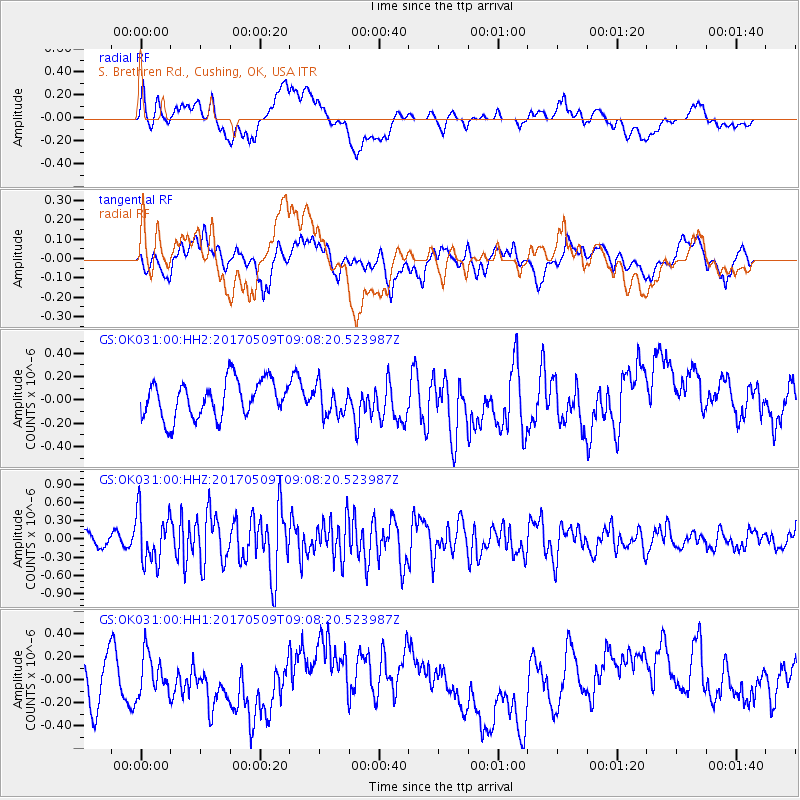
OK031 S. Brethren Rd., Cushing, OK, USA - Earthquake Result Viewer
*The percent match for this event was below the threshold and hence no stack was calculated.
| Earthquake location: |
Andreanof Islands, Aleutian Is. |
| Earthquake latitude/longitude: |
51.2/-177.2 |
| Earthquake time(UTC): |
2017/05/09 (129) 08:59:06 GMT |
| Earthquake Depth: |
31 km |
| Earthquake Magnitude: |
5.4 mww |
| Earthquake Catalog/Contributor: |
NEIC PDE/us |
|
| Network: |
GS US Geological Survey Networks |
| Station: |
OK031 S. Brethren Rd., Cushing, OK, USA |
| Lat/Lon: |
35.95 N/96.84 W |
| Elevation: |
290 m |
|
| Distance: |
57.3 deg |
| Az: |
71.862 deg |
| Baz: |
312.58 deg |
| Ray Param: |
$rayparam |
*The percent match for this event was below the threshold and hence was not used in the summary stack. |
|
| Radial Match: |
39.655273 % |
| Radial Bump: |
400 |
| Transverse Match: |
42.167767 % |
| Transverse Bump: |
400 |
| SOD ConfigId: |
2028011 |
| Insert Time: |
2017-05-23 09:06:18.301 +0000 |
| GWidth: |
2.5 |
| Max Bumps: |
400 |
| Tol: |
0.001 |
|
Signal To Noise
| Channel | StoN | STA | LTA |
| GS:OK031:00:HHZ:20170509T09:08:20.523987Z | 2.1816335 | 4.142679E-7 | 1.8988888E-7 |
| GS:OK031:00:HH1:20170509T09:08:20.523987Z | 0.63843054 | 1.7425084E-7 | 2.7293626E-7 |
| GS:OK031:00:HH2:20170509T09:08:20.523987Z | 0.8038766 | 1.267711E-7 | 1.576997E-7 |
| Arrivals |
| Ps | |
| PpPs | |
| PsPs/PpSs | |


