You are here: Home > Network List > IU - Global Seismograph Network (GSN - IRIS/USGS) Stations List
> Station RSSD Black Hills, South Dakota, USA > Earthquake Result Viewer
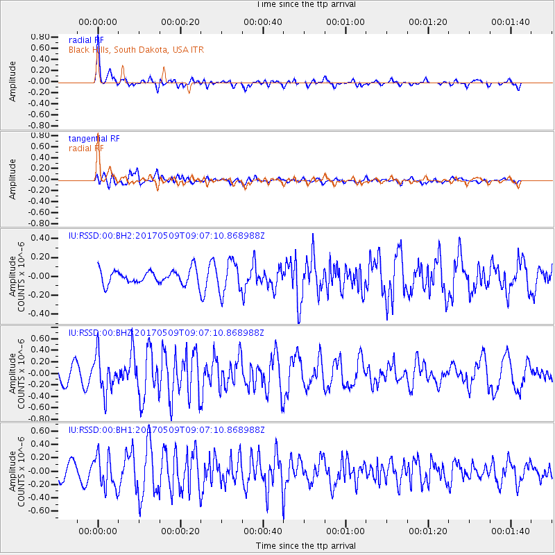
RSSD Black Hills, South Dakota, USA - Earthquake Result Viewer
*The percent match for this event was below the threshold and hence no stack was calculated.
| Earthquake location: |
Andreanof Islands, Aleutian Is. |
| Earthquake latitude/longitude: |
51.2/-177.2 |
| Earthquake time(UTC): |
2017/05/09 (129) 08:59:06 GMT |
| Earthquake Depth: |
31 km |
| Earthquake Magnitude: |
5.4 mww |
| Earthquake Catalog/Contributor: |
NEIC PDE/us |
|
| Network: |
IU Global Seismograph Network (GSN - IRIS/USGS) |
| Station: |
RSSD Black Hills, South Dakota, USA |
| Lat/Lon: |
44.12 N/104.04 W |
| Elevation: |
2090 m |
|
| Distance: |
47.9 deg |
| Az: |
68.315 deg |
| Baz: |
305.792 deg |
| Ray Param: |
$rayparam |
*The percent match for this event was below the threshold and hence was not used in the summary stack. |
|
| Radial Match: |
73.16666 % |
| Radial Bump: |
341 |
| Transverse Match: |
63.696712 % |
| Transverse Bump: |
400 |
| SOD ConfigId: |
2028011 |
| Insert Time: |
2017-05-23 09:06:56.513 +0000 |
| GWidth: |
2.5 |
| Max Bumps: |
400 |
| Tol: |
0.001 |
|
Signal To Noise
| Channel | StoN | STA | LTA |
| IU:RSSD:00:BHZ:20170509T09:07:10.868988Z | 2.2889202 | 3.26475E-7 | 1.4263276E-7 |
| IU:RSSD:00:BH1:20170509T09:07:10.868988Z | 2.5610373 | 2.4915084E-7 | 9.728513E-8 |
| IU:RSSD:00:BH2:20170509T09:07:10.868988Z | 2.2957387 | 1.6825227E-7 | 7.3288945E-8 |
| Arrivals |
| Ps | |
| PpPs | |
| PsPs/PpSs | |


