You are here: Home > Network List > TA - USArray Transportable Network (new EarthScope stations) Stations List
> Station E18K Tukpahlearik Creek, AK, USA > Earthquake Result Viewer
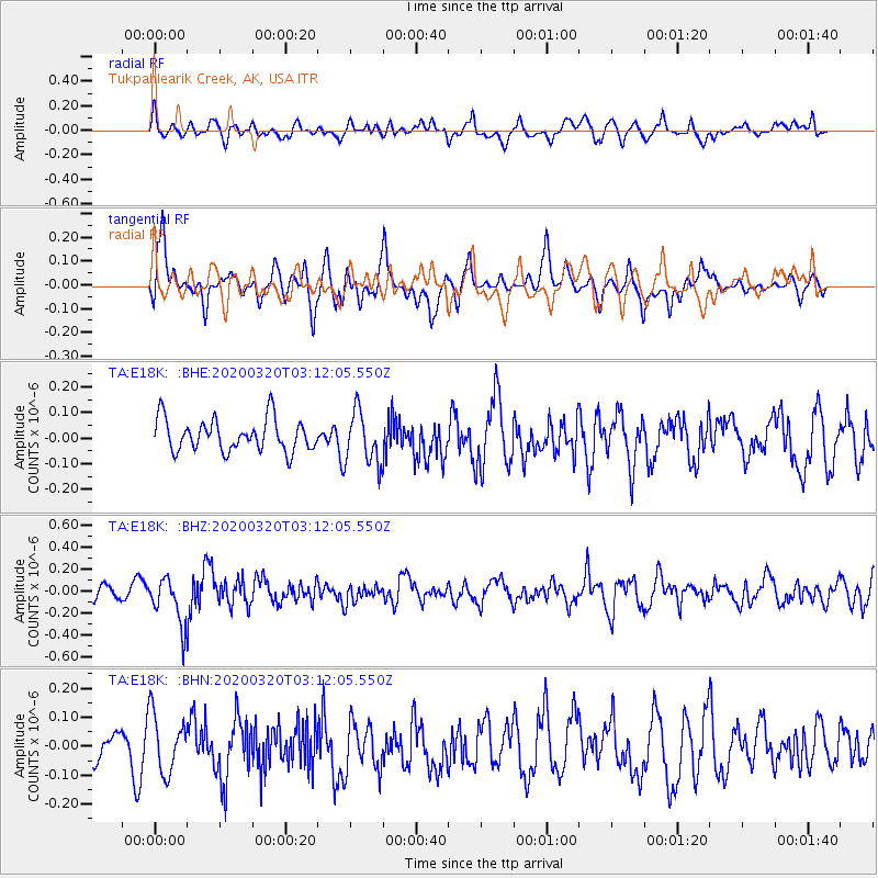
E18K Tukpahlearik Creek, AK, USA - Earthquake Result Viewer
*The percent match for this event was below the threshold and hence no stack was calculated.
| Earthquake location: |
Mongolia |
| Earthquake latitude/longitude: |
46.1/94.0 |
| Earthquake time(UTC): |
2020/03/20 (080) 03:03:13 GMT |
| Earthquake Depth: |
10 km |
| Earthquake Magnitude: |
5.5 Mww |
| Earthquake Catalog/Contributor: |
NEIC PDE/us |
|
| Network: |
TA USArray Transportable Network (new EarthScope stations) |
| Station: |
E18K Tukpahlearik Creek, AK, USA |
| Lat/Lon: |
67.42 N/160.60 W |
| Elevation: |
297 m |
|
| Distance: |
53.8 deg |
| Az: |
27.464 deg |
| Baz: |
303.728 deg |
| Ray Param: |
$rayparam |
*The percent match for this event was below the threshold and hence was not used in the summary stack. |
|
| Radial Match: |
57.250072 % |
| Radial Bump: |
400 |
| Transverse Match: |
60.22684 % |
| Transverse Bump: |
400 |
| SOD ConfigId: |
20906531 |
| Insert Time: |
2020-04-08 13:13:58.324 +0000 |
| GWidth: |
2.5 |
| Max Bumps: |
400 |
| Tol: |
0.001 |
|
Signal To Noise
| Channel | StoN | STA | LTA |
| TA:E18K: :BHZ:20200320T03:12:05.550Z | 2.1230016 | 2.147743E-7 | 1.01165405E-7 |
| TA:E18K: :BHN:20200320T03:12:05.550Z | 1.2632318 | 1.0121175E-7 | 8.012128E-8 |
| TA:E18K: :BHE:20200320T03:12:05.550Z | 1.6590114 | 1.0425409E-7 | 6.2841096E-8 |
| Arrivals |
| Ps | |
| PpPs | |
| PsPs/PpSs | |


