RPV Rancho Palos Verde California, USA - Earthquake Result Viewer
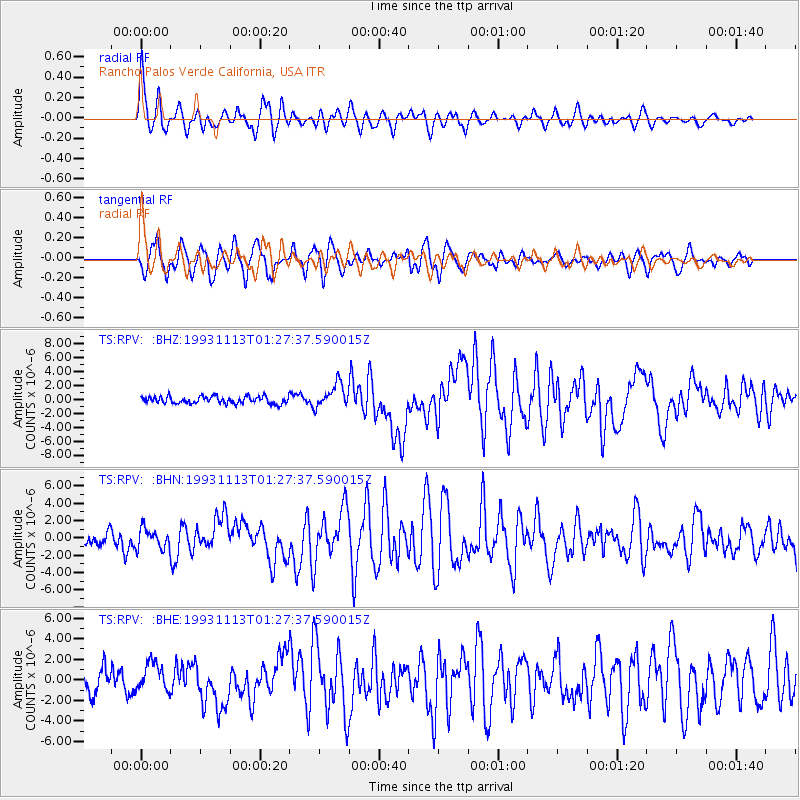
Earthquake location: Near East Coast Of Kamchatka
Earthquake latitude/longitude: 51.9/158.7
Earthquake time(UTC): 1993/11/13 (317) 01:18:04 GMT
Earthquake Depth: 34 km
Earthquake Magnitude: 6.5 MB, 7.1 MS, 6.9 UNKNOWN
Earthquake Catalog/Contributor: WHDF/NEIC
Network: TS TERRAscope (Southern California Seismic Network)
Station: RPV Rancho Palos Verde California, USA
Lat/Lon: 33.74 N/118.40 W
Elevation: 115 m
Distance: 60.1 deg
Az: 72.45 deg
Baz: 314.872 deg
Ray Param: 0.06167273
Estimated Moho Depth: 21.5 km
Estimated Crust Vp/Vs: 1.82
Assumed Crust Vp: 6.048 km/s
Estimated Crust Vs: 3.318 km/s
Estimated Crust Poisson's Ratio: 0.28
Radial Match: 90.090706 %
Radial Bump: 400
Transverse Match: 82.00003 %
Transverse Bump: 400
SOD ConfigId: 16938
Insert Time: 2010-02-26 14:44:41.404 +0000
GWidth: 2.5
Max Bumps: 400
Tol: 0.001

Signal To Noise

ChannelStoNSTALTA
TS:RPV: :BHN:19931113T01:27:37.590015Z1.21464861.1497049E-69.465329E-7
TS:RPV: :BHE:19931113T01:27:37.590015Z1.3353231.3964711E-61.0457927E-6
TS:RPV: :BHZ:19931113T01:27:37.590015Z3.30000781.6811078E-65.0942543E-7
Arrivals
Ps3.0 SECOND
PpPs9.6 SECOND
PsPs/PpSs13 SECOND