You are here: Home > Network List > US - United States National Seismic Network Stations List
> Station DGMT Dagmar, Montana, USA > Earthquake Result Viewer
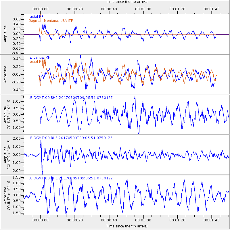
DGMT Dagmar, Montana, USA - Earthquake Result Viewer
*The percent match for this event was below the threshold and hence no stack was calculated.
| Earthquake location: |
Andreanof Islands, Aleutian Is. |
| Earthquake latitude/longitude: |
51.2/-177.2 |
| Earthquake time(UTC): |
2017/05/09 (129) 08:59:06 GMT |
| Earthquake Depth: |
31 km |
| Earthquake Magnitude: |
5.4 mww |
| Earthquake Catalog/Contributor: |
NEIC PDE/us |
|
| Network: |
US United States National Seismic Network |
| Station: |
DGMT Dagmar, Montana, USA |
| Lat/Lon: |
48.47 N/104.20 W |
| Elevation: |
0.0 m |
|
| Distance: |
45.4 deg |
| Az: |
63.443 deg |
| Baz: |
302.329 deg |
| Ray Param: |
$rayparam |
*The percent match for this event was below the threshold and hence was not used in the summary stack. |
|
| Radial Match: |
49.64437 % |
| Radial Bump: |
400 |
| Transverse Match: |
51.397545 % |
| Transverse Bump: |
400 |
| SOD ConfigId: |
2028011 |
| Insert Time: |
2017-05-23 09:08:42.334 +0000 |
| GWidth: |
2.5 |
| Max Bumps: |
400 |
| Tol: |
0.001 |
|
Signal To Noise
| Channel | StoN | STA | LTA |
| US:DGMT:00:BHZ:20170509T09:06:51.075012Z | 3.515118 | 9.451223E-7 | 2.6887355E-7 |
| US:DGMT:00:BH1:20170509T09:06:51.075012Z | 2.4182544 | 8.219792E-7 | 3.3990602E-7 |
| US:DGMT:00:BH2:20170509T09:06:51.075012Z | 0.9086474 | 5.157553E-7 | 5.676077E-7 |
| Arrivals |
| Ps | |
| PpPs | |
| PsPs/PpSs | |


