You are here: Home > Network List > G - GEOSCOPE Stations List
> Station INU Inuyama, Japan > Earthquake Result Viewer
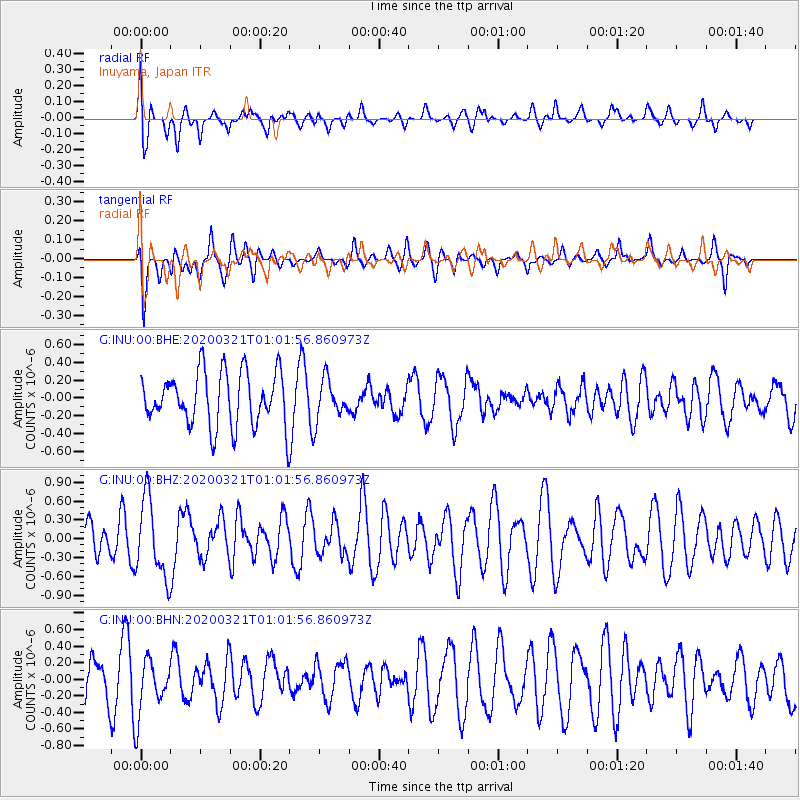
INU Inuyama, Japan - Earthquake Result Viewer
*The percent match for this event was below the threshold and hence no stack was calculated.
| Earthquake location: |
Greece-Albania Border Region |
| Earthquake latitude/longitude: |
39.4/20.6 |
| Earthquake time(UTC): |
2020/03/21 (081) 00:49:51 GMT |
| Earthquake Depth: |
10 km |
| Earthquake Magnitude: |
5.7 Mww |
| Earthquake Catalog/Contributor: |
NEIC PDE/us |
|
| Network: |
G GEOSCOPE |
| Station: |
INU Inuyama, Japan |
| Lat/Lon: |
35.35 N/137.03 E |
| Elevation: |
132 m |
|
| Distance: |
85.3 deg |
| Az: |
47.284 deg |
| Baz: |
315.841 deg |
| Ray Param: |
$rayparam |
*The percent match for this event was below the threshold and hence was not used in the summary stack. |
|
| Radial Match: |
60.22 % |
| Radial Bump: |
400 |
| Transverse Match: |
53.63055 % |
| Transverse Bump: |
341 |
| SOD ConfigId: |
20906531 |
| Insert Time: |
2020-04-08 13:28:53.161 +0000 |
| GWidth: |
2.5 |
| Max Bumps: |
400 |
| Tol: |
0.001 |
|
Signal To Noise
| Channel | StoN | STA | LTA |
| G:INU:00:BHZ:20200321T01:01:56.860973Z | 2.2515385 | 6.1492057E-7 | 2.7311128E-7 |
| G:INU:00:BHN:20200321T01:01:56.860973Z | 2.2478368 | 3.2875784E-7 | 1.462552E-7 |
| G:INU:00:BHE:20200321T01:01:56.860973Z | 0.75145304 | 2.2674762E-7 | 3.0174556E-7 |
| Arrivals |
| Ps | |
| PpPs | |
| PsPs/PpSs | |


