You are here: Home > Network List > IW - Intermountain West Stations List
> Station MOOW Moose Ponds, Wyoming, USA > Earthquake Result Viewer
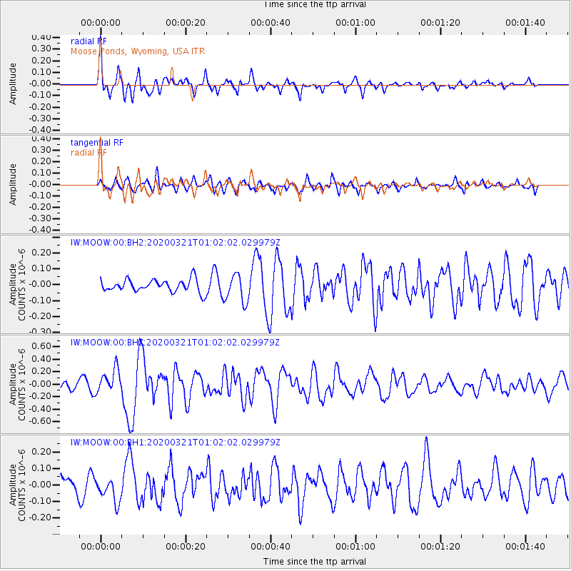
MOOW Moose Ponds, Wyoming, USA - Earthquake Result Viewer
*The percent match for this event was below the threshold and hence no stack was calculated.
| Earthquake location: |
Greece-Albania Border Region |
| Earthquake latitude/longitude: |
39.4/20.6 |
| Earthquake time(UTC): |
2020/03/21 (081) 00:49:51 GMT |
| Earthquake Depth: |
10 km |
| Earthquake Magnitude: |
5.7 Mww |
| Earthquake Catalog/Contributor: |
NEIC PDE/us |
|
| Network: |
IW Intermountain West |
| Station: |
MOOW Moose Ponds, Wyoming, USA |
| Lat/Lon: |
43.75 N/110.74 W |
| Elevation: |
2128 m |
|
| Distance: |
86.3 deg |
| Az: |
326.982 deg |
| Baz: |
35.648 deg |
| Ray Param: |
$rayparam |
*The percent match for this event was below the threshold and hence was not used in the summary stack. |
|
| Radial Match: |
78.72472 % |
| Radial Bump: |
384 |
| Transverse Match: |
53.754314 % |
| Transverse Bump: |
400 |
| SOD ConfigId: |
20906531 |
| Insert Time: |
2020-04-08 13:30:40.884 +0000 |
| GWidth: |
2.5 |
| Max Bumps: |
400 |
| Tol: |
0.001 |
|
Signal To Noise
| Channel | StoN | STA | LTA |
| IW:MOOW:00:BHZ:20200321T01:02:02.029979Z | 2.8804202 | 1.9394557E-7 | 6.733239E-8 |
| IW:MOOW:00:BH1:20200321T01:02:02.029979Z | 1.465634 | 7.4810345E-8 | 5.1042996E-8 |
| IW:MOOW:00:BH2:20200321T01:02:02.029979Z | 2.3170662 | 8.9300336E-8 | 3.854026E-8 |
| Arrivals |
| Ps | |
| PpPs | |
| PsPs/PpSs | |


