You are here: Home > Network List > US - United States National Seismic Network Stations List
> Station WMOK Wichita Mountains, Oklahoma, USA > Earthquake Result Viewer
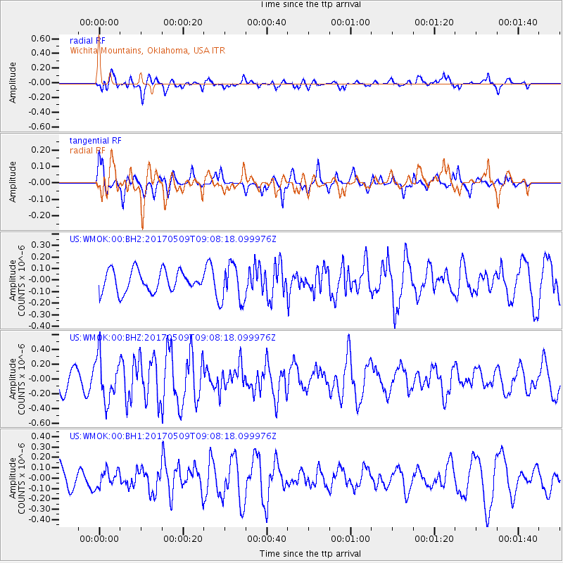
WMOK Wichita Mountains, Oklahoma, USA - Earthquake Result Viewer
*The percent match for this event was below the threshold and hence no stack was calculated.
| Earthquake location: |
Andreanof Islands, Aleutian Is. |
| Earthquake latitude/longitude: |
51.2/-177.2 |
| Earthquake time(UTC): |
2017/05/09 (129) 08:59:06 GMT |
| Earthquake Depth: |
31 km |
| Earthquake Magnitude: |
5.4 mww |
| Earthquake Catalog/Contributor: |
NEIC PDE/us |
|
| Network: |
US United States National Seismic Network |
| Station: |
WMOK Wichita Mountains, Oklahoma, USA |
| Lat/Lon: |
34.74 N/98.78 W |
| Elevation: |
486 m |
|
| Distance: |
57.0 deg |
| Az: |
74.203 deg |
| Baz: |
312.731 deg |
| Ray Param: |
$rayparam |
*The percent match for this event was below the threshold and hence was not used in the summary stack. |
|
| Radial Match: |
61.76274 % |
| Radial Bump: |
400 |
| Transverse Match: |
55.384514 % |
| Transverse Bump: |
400 |
| SOD ConfigId: |
2028011 |
| Insert Time: |
2017-05-23 09:09:38.170 +0000 |
| GWidth: |
2.5 |
| Max Bumps: |
400 |
| Tol: |
0.001 |
|
Signal To Noise
| Channel | StoN | STA | LTA |
| US:WMOK:00:BHZ:20170509T09:08:18.099976Z | 1.9989688 | 3.0271337E-7 | 1.5143476E-7 |
| US:WMOK:00:BH1:20170509T09:08:18.099976Z | 0.709213 | 7.690942E-8 | 1.0844334E-7 |
| US:WMOK:00:BH2:20170509T09:08:18.099976Z | 1.7892848 | 1.6332946E-7 | 9.128198E-8 |
| Arrivals |
| Ps | |
| PpPs | |
| PsPs/PpSs | |


