You are here: Home > Network List > TA - USArray Transportable Network (new EarthScope stations) Stations List
> Station C16K Lisburne Hills, AK, USA > Earthquake Result Viewer
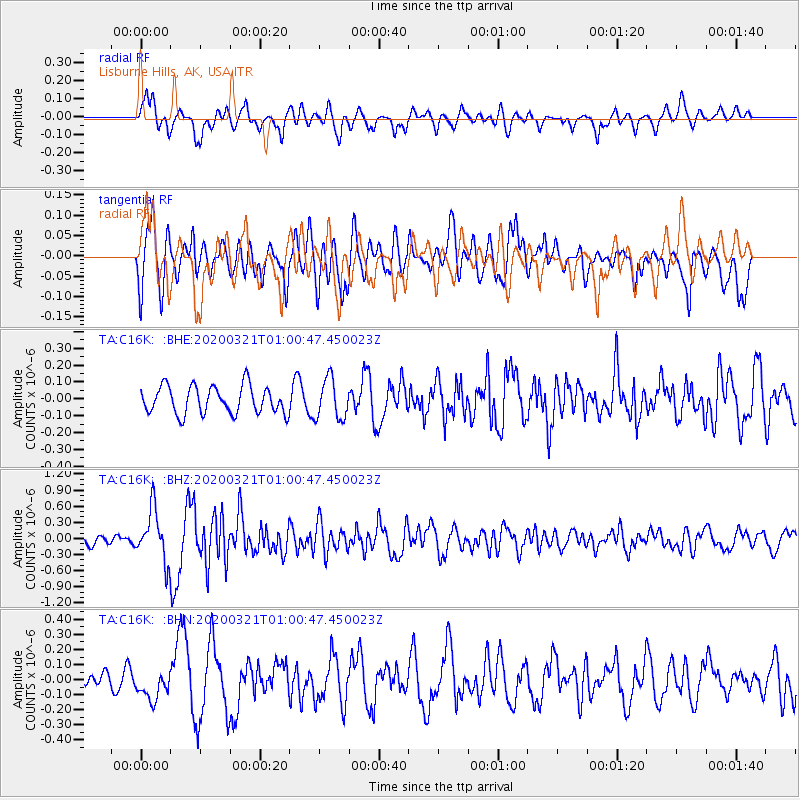
C16K Lisburne Hills, AK, USA - Earthquake Result Viewer
*The percent match for this event was below the threshold and hence no stack was calculated.
| Earthquake location: |
Greece-Albania Border Region |
| Earthquake latitude/longitude: |
39.4/20.6 |
| Earthquake time(UTC): |
2020/03/21 (081) 00:49:51 GMT |
| Earthquake Depth: |
10 km |
| Earthquake Magnitude: |
5.7 Mww |
| Earthquake Catalog/Contributor: |
NEIC PDE/us |
|
| Network: |
TA USArray Transportable Network (new EarthScope stations) |
| Station: |
C16K Lisburne Hills, AK, USA |
| Lat/Lon: |
68.27 N/165.34 W |
| Elevation: |
102 m |
|
| Distance: |
72.6 deg |
| Az: |
2.329 deg |
| Baz: |
355.148 deg |
| Ray Param: |
$rayparam |
*The percent match for this event was below the threshold and hence was not used in the summary stack. |
|
| Radial Match: |
77.27729 % |
| Radial Bump: |
400 |
| Transverse Match: |
74.94706 % |
| Transverse Bump: |
400 |
| SOD ConfigId: |
20906531 |
| Insert Time: |
2020-04-08 13:39:54.060 +0000 |
| GWidth: |
2.5 |
| Max Bumps: |
400 |
| Tol: |
0.001 |
|
Signal To Noise
| Channel | StoN | STA | LTA |
| TA:C16K: :BHZ:20200321T01:00:47.450023Z | 5.1490674 | 4.7233158E-7 | 9.1731486E-8 |
| TA:C16K: :BHN:20200321T01:00:47.450023Z | 1.329268 | 9.602519E-8 | 7.2239146E-8 |
| TA:C16K: :BHE:20200321T01:00:47.450023Z | 1.4450903 | 1.1844151E-7 | 8.1961325E-8 |
| Arrivals |
| Ps | |
| PpPs | |
| PsPs/PpSs | |


