You are here: Home > Network List > TA - USArray Transportable Network (new EarthScope stations) Stations List
> Station G21K Allakaket, AK, USA > Earthquake Result Viewer
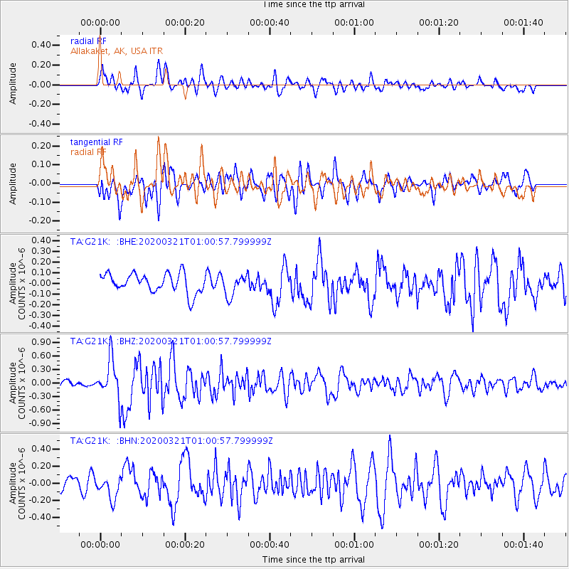
G21K Allakaket, AK, USA - Earthquake Result Viewer
*The percent match for this event was below the threshold and hence no stack was calculated.
| Earthquake location: |
Greece-Albania Border Region |
| Earthquake latitude/longitude: |
39.4/20.6 |
| Earthquake time(UTC): |
2020/03/21 (081) 00:49:51 GMT |
| Earthquake Depth: |
10 km |
| Earthquake Magnitude: |
5.7 Mww |
| Earthquake Catalog/Contributor: |
NEIC PDE/us |
|
| Network: |
TA USArray Transportable Network (new EarthScope stations) |
| Station: |
G21K Allakaket, AK, USA |
| Lat/Lon: |
66.52 N/153.51 W |
| Elevation: |
446 m |
|
| Distance: |
74.3 deg |
| Az: |
357.564 deg |
| Baz: |
4.715 deg |
| Ray Param: |
$rayparam |
*The percent match for this event was below the threshold and hence was not used in the summary stack. |
|
| Radial Match: |
61.82629 % |
| Radial Bump: |
400 |
| Transverse Match: |
61.884987 % |
| Transverse Bump: |
400 |
| SOD ConfigId: |
20906531 |
| Insert Time: |
2020-04-08 13:40:56.950 +0000 |
| GWidth: |
2.5 |
| Max Bumps: |
400 |
| Tol: |
0.001 |
|
Signal To Noise
| Channel | StoN | STA | LTA |
| TA:G21K: :BHZ:20200321T01:00:57.799999Z | 3.5296075 | 4.616315E-7 | 1.3078834E-7 |
| TA:G21K: :BHN:20200321T01:00:57.799999Z | 0.97711575 | 1.3398041E-7 | 1.3711825E-7 |
| TA:G21K: :BHE:20200321T01:00:57.799999Z | 1.1514914 | 1.0357228E-7 | 8.994621E-8 |
| Arrivals |
| Ps | |
| PpPs | |
| PsPs/PpSs | |


