You are here: Home > Network List > TA - USArray Transportable Network (new EarthScope stations) Stations List
> Station H16K Elim, AK, USA > Earthquake Result Viewer
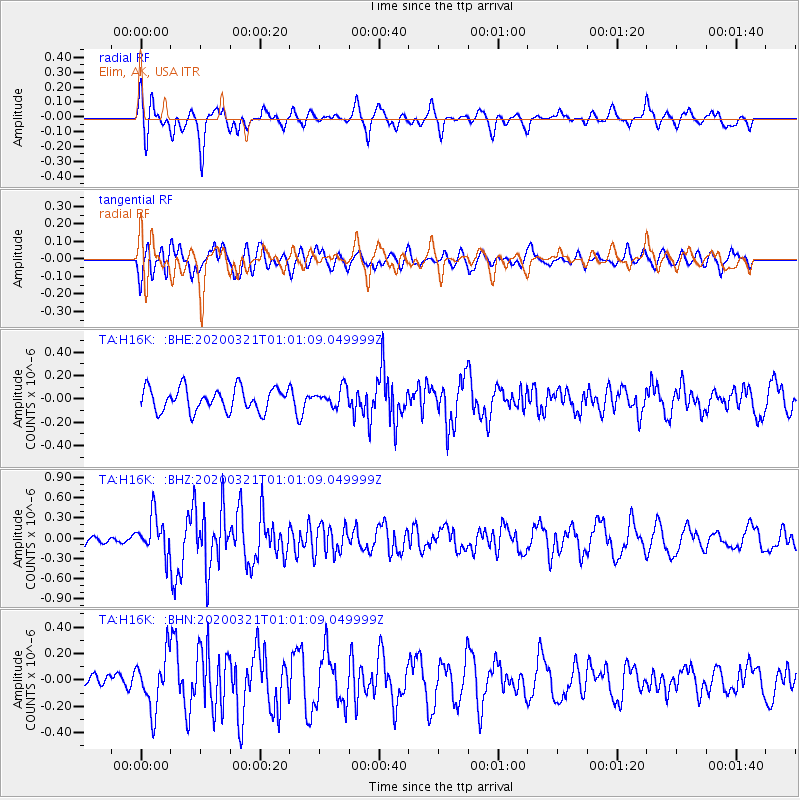
H16K Elim, AK, USA - Earthquake Result Viewer
*The percent match for this event was below the threshold and hence no stack was calculated.
| Earthquake location: |
Greece-Albania Border Region |
| Earthquake latitude/longitude: |
39.4/20.6 |
| Earthquake time(UTC): |
2020/03/21 (081) 00:49:51 GMT |
| Earthquake Depth: |
10 km |
| Earthquake Magnitude: |
5.7 Mww |
| Earthquake Catalog/Contributor: |
NEIC PDE/us |
|
| Network: |
TA USArray Transportable Network (new EarthScope stations) |
| Station: |
H16K Elim, AK, USA |
| Lat/Lon: |
64.64 N/162.24 W |
| Elevation: |
216 m |
|
| Distance: |
76.3 deg |
| Az: |
1.273 deg |
| Baz: |
357.709 deg |
| Ray Param: |
$rayparam |
*The percent match for this event was below the threshold and hence was not used in the summary stack. |
|
| Radial Match: |
57.447254 % |
| Radial Bump: |
400 |
| Transverse Match: |
56.13835 % |
| Transverse Bump: |
400 |
| SOD ConfigId: |
20906531 |
| Insert Time: |
2020-04-08 13:41:09.744 +0000 |
| GWidth: |
2.5 |
| Max Bumps: |
400 |
| Tol: |
0.001 |
|
Signal To Noise
| Channel | StoN | STA | LTA |
| TA:H16K: :BHZ:20200321T01:01:09.049999Z | 3.0454068 | 2.8040333E-7 | 9.207418E-8 |
| TA:H16K: :BHN:20200321T01:01:09.049999Z | 2.2139633 | 2.0309912E-7 | 9.1735544E-8 |
| TA:H16K: :BHE:20200321T01:01:09.049999Z | 0.79114354 | 7.7758244E-8 | 9.8285895E-8 |
| Arrivals |
| Ps | |
| PpPs | |
| PsPs/PpSs | |


