You are here: Home > Network List > TA - USArray Transportable Network (new EarthScope stations) Stations List
> Station O17K Koliganek, Bristol Bay, AK, USA > Earthquake Result Viewer
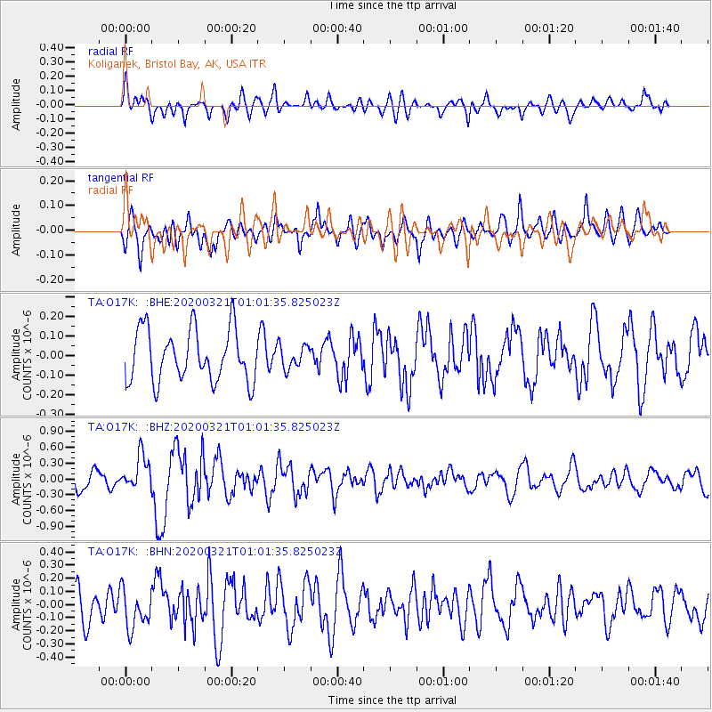
O17K Koliganek, Bristol Bay, AK, USA - Earthquake Result Viewer
*The percent match for this event was below the threshold and hence no stack was calculated.
| Earthquake location: |
Greece-Albania Border Region |
| Earthquake latitude/longitude: |
39.4/20.6 |
| Earthquake time(UTC): |
2020/03/21 (081) 00:49:51 GMT |
| Earthquake Depth: |
10 km |
| Earthquake Magnitude: |
5.7 Mww |
| Earthquake Catalog/Contributor: |
NEIC PDE/us |
|
| Network: |
TA USArray Transportable Network (new EarthScope stations) |
| Station: |
O17K Koliganek, Bristol Bay, AK, USA |
| Lat/Lon: |
59.77 N/157.09 W |
| Elevation: |
156 m |
|
| Distance: |
81.2 deg |
| Az: |
358.837 deg |
| Baz: |
1.782 deg |
| Ray Param: |
$rayparam |
*The percent match for this event was below the threshold and hence was not used in the summary stack. |
|
| Radial Match: |
56.550797 % |
| Radial Bump: |
400 |
| Transverse Match: |
59.40042 % |
| Transverse Bump: |
400 |
| SOD ConfigId: |
20906531 |
| Insert Time: |
2020-04-08 13:42:07.116 +0000 |
| GWidth: |
2.5 |
| Max Bumps: |
400 |
| Tol: |
0.001 |
|
Signal To Noise
| Channel | StoN | STA | LTA |
| TA:O17K: :BHZ:20200321T01:01:35.825023Z | 2.3031294 | 3.253328E-7 | 1.4125685E-7 |
| TA:O17K: :BHN:20200321T01:01:35.825023Z | 1.112265 | 1.5114598E-7 | 1.3589026E-7 |
| TA:O17K: :BHE:20200321T01:01:35.825023Z | 0.43906757 | 5.8164385E-8 | 1.3247251E-7 |
| Arrivals |
| Ps | |
| PpPs | |
| PsPs/PpSs | |


