You are here: Home > Network List > US - United States National Seismic Network Stations List
> Station EGMT Eagleton, Montana, USA > Earthquake Result Viewer
EGMT Eagleton, Montana, USA - Earthquake Result Viewer
*The percent match for this event was below the threshold and hence no stack was calculated.
| Earthquake location: |
Greece-Albania Border Region |
| Earthquake latitude/longitude: |
39.4/20.6 |
| Earthquake time(UTC): |
2020/03/21 (081) 00:49:51 GMT |
| Earthquake Depth: |
10 km |
| Earthquake Magnitude: |
5.7 Mww |
| Earthquake Catalog/Contributor: |
NEIC PDE/us |
|
| Network: |
US United States National Seismic Network |
| Station: |
EGMT Eagleton, Montana, USA |
| Lat/Lon: |
48.02 N/109.75 W |
| Elevation: |
1055 m |
|
| Distance: |
82.5 deg |
| Az: |
328.951 deg |
| Baz: |
36.55 deg |
| Ray Param: |
$rayparam |
*The percent match for this event was below the threshold and hence was not used in the summary stack. |
|
| Radial Match: |
74.951164 % |
| Radial Bump: |
400 |
| Transverse Match: |
62.87309 % |
| Transverse Bump: |
400 |
| SOD ConfigId: |
20906531 |
| Insert Time: |
2020-04-08 13:44:51.870 +0000 |
| GWidth: |
2.5 |
| Max Bumps: |
400 |
| Tol: |
0.001 |
|
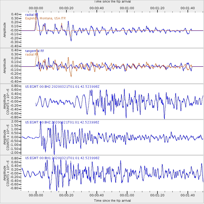
Signal To Noise
| Channel | StoN | STA | LTA |
| US:EGMT:00:BHZ:20200321T01:01:42.523998Z | 7.815023 | 6.754582E-7 | 8.643074E-8 |
| US:EGMT:00:BH1:20200321T01:01:42.523998Z | 0.529078 | 1.0806064E-7 | 2.0424329E-7 |
| US:EGMT:00:BH2:20200321T01:01:42.523998Z | 2.776434 | 3.252962E-7 | 1.1716332E-7 |
| Arrivals |
| Ps | |
| PpPs | |
| PsPs/PpSs | |


