You are here: Home > Network List > TA - USArray Transportable Network (new EarthScope stations) Stations List
> Station F21K Alatna River, AK, USA > Earthquake Result Viewer
F21K Alatna River, AK, USA - Earthquake Result Viewer
*The percent match for this event was below the threshold and hence no stack was calculated.
| Earthquake location: |
Northwestern Balkan Region |
| Earthquake latitude/longitude: |
45.9/16.0 |
| Earthquake time(UTC): |
2020/03/22 (082) 05:24:03 GMT |
| Earthquake Depth: |
10 km |
| Earthquake Magnitude: |
5.3 Mww |
| Earthquake Catalog/Contributor: |
NEIC PDE/us |
|
| Network: |
TA USArray Transportable Network (new EarthScope stations) |
| Station: |
F21K Alatna River, AK, USA |
| Lat/Lon: |
67.22 N/153.48 W |
| Elevation: |
597 m |
|
| Distance: |
66.9 deg |
| Az: |
355.556 deg |
| Baz: |
7.986 deg |
| Ray Param: |
$rayparam |
*The percent match for this event was below the threshold and hence was not used in the summary stack. |
|
| Radial Match: |
57.92171 % |
| Radial Bump: |
400 |
| Transverse Match: |
74.35368 % |
| Transverse Bump: |
400 |
| SOD ConfigId: |
20906531 |
| Insert Time: |
2020-04-08 14:05:09.888 +0000 |
| GWidth: |
2.5 |
| Max Bumps: |
400 |
| Tol: |
0.001 |
|
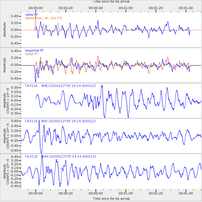
Signal To Noise
| Channel | StoN | STA | LTA |
| TA:F21K: :BHZ:20200322T05:34:24.900012Z | 2.5179098 | 3.7363688E-7 | 1.4839169E-7 |
| TA:F21K: :BHN:20200322T05:34:24.900012Z | 2.073673 | 2.0332322E-7 | 9.8049796E-8 |
| TA:F21K: :BHE:20200322T05:34:24.900012Z | 0.80737734 | 8.3231846E-8 | 1.0308916E-7 |
| Arrivals |
| Ps | |
| PpPs | |
| PsPs/PpSs | |


