
RPV Rancho Palos Verde California, USA - Earthquake Result Viewer
| ||||||||||||||||||
| ||||||||||||||||||
| ||||||||||||||||||
|
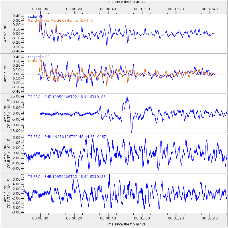
Signal To Noise
| Channel | StoN | STA | LTA |
| TS:RPV: :BHN:19950106T22:48:44.631018Z | 0.9482891 | 2.0248424E-6 | 2.1352585E-6 |
| TS:RPV: :BHE:19950106T22:48:44.631018Z | 0.5924629 | 7.9754756E-7 | 1.3461561E-6 |
| TS:RPV: :BHZ:19950106T22:48:44.631018Z | 1.7390499 | 1.2382786E-6 | 7.120431E-7 |
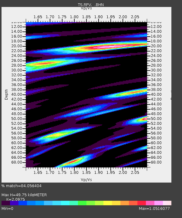
| Arrivals | |
| Ps | 9.2 SECOND |
| PpPs | 25 SECOND |
| PsPs/PpSs | 34 SECOND |

