You are here: Home > Network List > TA - USArray Transportable Network (new EarthScope stations) Stations List
> Station L15K Ungalak Mountain, AK, USA > Earthquake Result Viewer
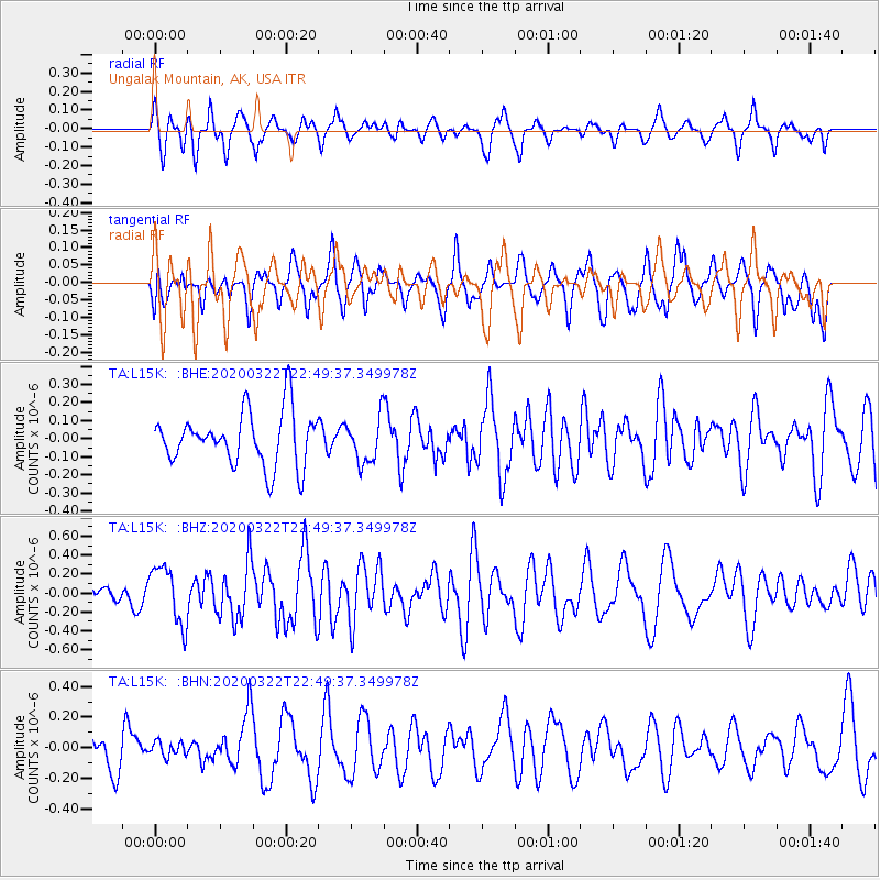
L15K Ungalak Mountain, AK, USA - Earthquake Result Viewer
*The percent match for this event was below the threshold and hence no stack was calculated.
| Earthquake location: |
Central East Pacific Rise |
| Earthquake latitude/longitude: |
-4.7/-105.0 |
| Earthquake time(UTC): |
2020/03/22 (082) 22:38:04 GMT |
| Earthquake Depth: |
10 km |
| Earthquake Magnitude: |
6.1 mww |
| Earthquake Catalog/Contributor: |
NEIC PDE/us |
|
| Network: |
TA USArray Transportable Network (new EarthScope stations) |
| Station: |
L15K Ungalak Mountain, AK, USA |
| Lat/Lon: |
61.68 N/161.49 W |
| Elevation: |
219 m |
|
| Distance: |
79.0 deg |
| Az: |
336.09 deg |
| Baz: |
122.105 deg |
| Ray Param: |
$rayparam |
*The percent match for this event was below the threshold and hence was not used in the summary stack. |
|
| Radial Match: |
61.034122 % |
| Radial Bump: |
400 |
| Transverse Match: |
34.573708 % |
| Transverse Bump: |
400 |
| SOD ConfigId: |
20906531 |
| Insert Time: |
2020-04-08 14:42:31.225 +0000 |
| GWidth: |
2.5 |
| Max Bumps: |
400 |
| Tol: |
0.001 |
|
Signal To Noise
| Channel | StoN | STA | LTA |
| TA:L15K: :BHZ:20200322T22:49:37.349978Z | 2.2134476 | 3.0266187E-7 | 1.3673777E-7 |
| TA:L15K: :BHN:20200322T22:49:37.349978Z | 0.34965414 | 4.9221374E-8 | 1.407716E-7 |
| TA:L15K: :BHE:20200322T22:49:37.349978Z | 0.8476921 | 1.2529767E-7 | 1.4781035E-7 |
| Arrivals |
| Ps | |
| PpPs | |
| PsPs/PpSs | |


