You are here: Home > Network List > TS - TERRAscope (Southern California Seismic Network) Stations List
> Station RPV Rancho Palos Verde California, USA > Earthquake Result Viewer
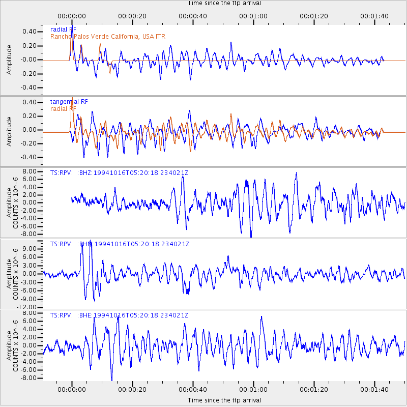
RPV Rancho Palos Verde California, USA - Earthquake Result Viewer
*The percent match for this event was below the threshold and hence no stack was calculated.
| Earthquake location: |
Kuril Islands |
| Earthquake latitude/longitude: |
45.7/149.2 |
| Earthquake time(UTC): |
1994/10/16 (289) 05:10:03 GMT |
| Earthquake Depth: |
139 km |
| Earthquake Magnitude: |
6.3 MB, 6.8 UNKNOWN, 6.7 MW |
| Earthquake Catalog/Contributor: |
WHDF/NEIC |
|
| Network: |
TS TERRAscope (Southern California Seismic Network) |
| Station: |
RPV Rancho Palos Verde California, USA |
| Lat/Lon: |
33.74 N/118.40 W |
| Elevation: |
115 m |
|
| Distance: |
68.3 deg |
| Az: |
63.679 deg |
| Baz: |
311.121 deg |
| Ray Param: |
$rayparam |
*The percent match for this event was below the threshold and hence was not used in the summary stack. |
|
| Radial Match: |
79.853714 % |
| Radial Bump: |
400 |
| Transverse Match: |
77.65304 % |
| Transverse Bump: |
400 |
| SOD ConfigId: |
4480 |
| Insert Time: |
2010-02-26 14:45:23.938 +0000 |
| GWidth: |
2.5 |
| Max Bumps: |
400 |
| Tol: |
0.001 |
|
Signal To Noise
| Channel | StoN | STA | LTA |
| TS:RPV: :BHN:19941016T05:20:18.234021Z | 7.3240223 | 4.5696825E-6 | 6.239307E-7 |
| TS:RPV: :BHE:19941016T05:20:18.234021Z | 1.0373006 | 1.3216031E-6 | 1.2740792E-6 |
| TS:RPV: :BHZ:19941016T05:20:18.234021Z | 1.5579442 | 1.7580163E-6 | 1.1284206E-6 |
| Arrivals |
| Ps | |
| PpPs | |
| PsPs/PpSs | |


