You are here: Home > Network List > US - United States National Seismic Network Stations List
> Station HAWA Hanford, Washington, USA > Earthquake Result Viewer
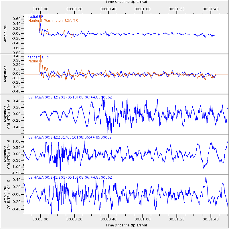
HAWA Hanford, Washington, USA - Earthquake Result Viewer
*The percent match for this event was below the threshold and hence no stack was calculated.
| Earthquake location: |
Andreanof Islands, Aleutian Is. |
| Earthquake latitude/longitude: |
51.4/-178.5 |
| Earthquake time(UTC): |
2017/05/10 (130) 07:59:55 GMT |
| Earthquake Depth: |
1.0 km |
| Earthquake Magnitude: |
6.0 Mi |
| Earthquake Catalog/Contributor: |
NEIC PDE/at |
|
| Network: |
US United States National Seismic Network |
| Station: |
HAWA Hanford, Washington, USA |
| Lat/Lon: |
46.39 N/119.53 W |
| Elevation: |
364 m |
|
| Distance: |
38.1 deg |
| Az: |
73.715 deg |
| Baz: |
299.77 deg |
| Ray Param: |
$rayparam |
*The percent match for this event was below the threshold and hence was not used in the summary stack. |
|
| Radial Match: |
61.184673 % |
| Radial Bump: |
400 |
| Transverse Match: |
55.504448 % |
| Transverse Bump: |
400 |
| SOD ConfigId: |
2028011 |
| Insert Time: |
2017-05-24 08:05:11.052 +0000 |
| GWidth: |
2.5 |
| Max Bumps: |
400 |
| Tol: |
0.001 |
|
Signal To Noise
| Channel | StoN | STA | LTA |
| US:HAWA:00:BHZ:20170510T08:06:44.850006Z | 3.092987 | 4.452889E-7 | 1.4396727E-7 |
| US:HAWA:00:BH1:20170510T08:06:44.850006Z | 0.82253987 | 1.2114268E-7 | 1.472788E-7 |
| US:HAWA:00:BH2:20170510T08:06:44.850006Z | 1.833969 | 2.18536E-7 | 1.19160134E-7 |
| Arrivals |
| Ps | |
| PpPs | |
| PsPs/PpSs | |


