You are here: Home > Network List > TS - TERRAscope (Southern California Seismic Network) Stations List
> Station RPV Rancho Palos Verde California, USA > Earthquake Result Viewer
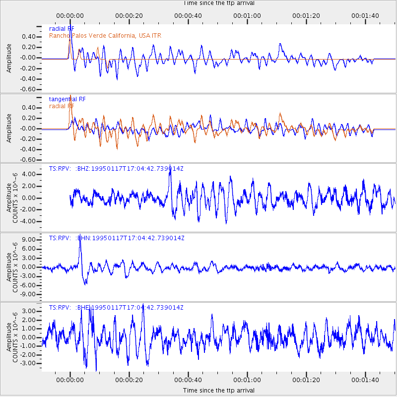
RPV Rancho Palos Verde California, USA - Earthquake Result Viewer
*The percent match for this event was below the threshold and hence no stack was calculated.
| Earthquake location: |
Fiji Islands Region |
| Earthquake latitude/longitude: |
-20.9/-179.2 |
| Earthquake time(UTC): |
1995/01/17 (017) 16:54:12 GMT |
| Earthquake Depth: |
637 km |
| Earthquake Magnitude: |
6.0 MB, 6.2 UNKNOWN, 6.4 MW |
| Earthquake Catalog/Contributor: |
WHDF/NEIC |
|
| Network: |
TS TERRAscope (Southern California Seismic Network) |
| Station: |
RPV Rancho Palos Verde California, USA |
| Lat/Lon: |
33.74 N/118.40 W |
| Elevation: |
115 m |
|
| Distance: |
79.4 deg |
| Az: |
47.745 deg |
| Baz: |
236.172 deg |
| Ray Param: |
$rayparam |
*The percent match for this event was below the threshold and hence was not used in the summary stack. |
|
| Radial Match: |
76.136505 % |
| Radial Bump: |
400 |
| Transverse Match: |
61.46701 % |
| Transverse Bump: |
400 |
| SOD ConfigId: |
4480 |
| Insert Time: |
2010-02-26 14:45:35.616 +0000 |
| GWidth: |
2.5 |
| Max Bumps: |
400 |
| Tol: |
0.001 |
|
Signal To Noise
| Channel | StoN | STA | LTA |
| TS:RPV: :BHN:19950117T17:04:42.739014Z | 6.3690753 | 3.3675828E-6 | 5.287397E-7 |
| TS:RPV: :BHE:19950117T17:04:42.739014Z | 1.6253566 | 1.3249837E-6 | 8.151957E-7 |
| TS:RPV: :BHZ:19950117T17:04:42.739014Z | 2.3409684 | 1.8081961E-6 | 7.724137E-7 |
| Arrivals |
| Ps | |
| PpPs | |
| PsPs/PpSs | |


