You are here: Home > Network List > TS - TERRAscope (Southern California Seismic Network) Stations List
> Station RPV Rancho Palos Verde California, USA > Earthquake Result Viewer
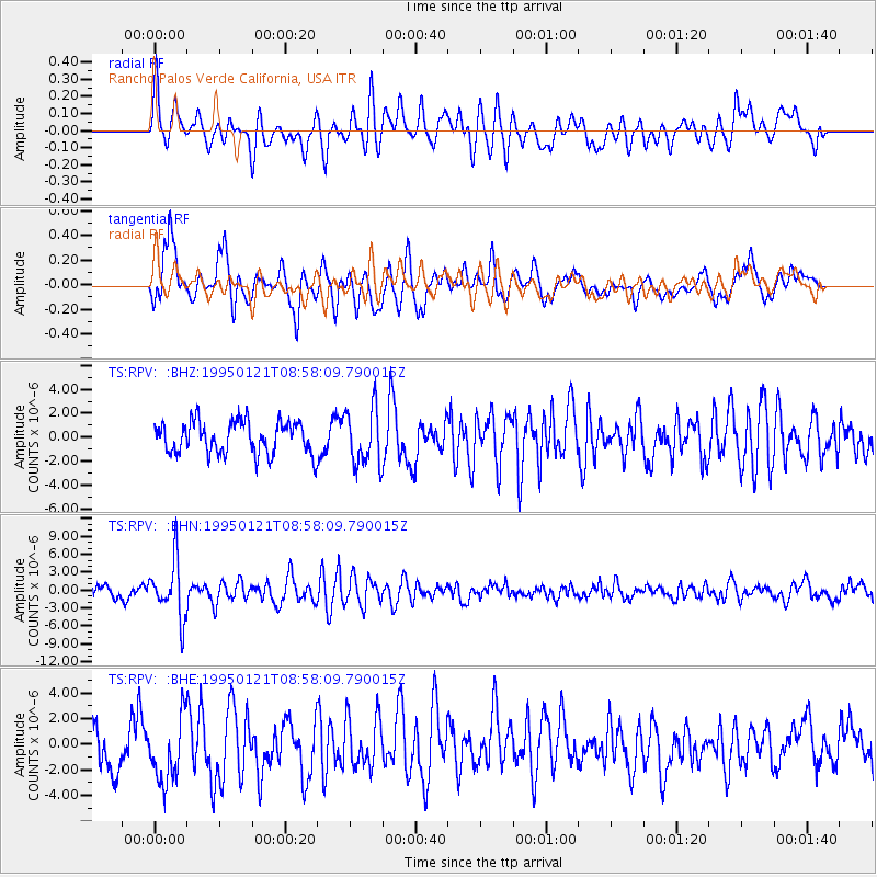
RPV Rancho Palos Verde California, USA - Earthquake Result Viewer
*The percent match for this event was below the threshold and hence no stack was calculated.
| Earthquake location: |
Kuril Islands |
| Earthquake latitude/longitude: |
43.3/146.7 |
| Earthquake time(UTC): |
1995/01/21 (021) 08:47:29 GMT |
| Earthquake Depth: |
63 km |
| Earthquake Magnitude: |
6.5 MB, 6.6 UNKNOWN, 6.4 MW |
| Earthquake Catalog/Contributor: |
WHDF/NEIC |
|
| Network: |
TS TERRAscope (Southern California Seismic Network) |
| Station: |
RPV Rancho Palos Verde California, USA |
| Lat/Lon: |
33.74 N/118.40 W |
| Elevation: |
115 m |
|
| Distance: |
71.0 deg |
| Az: |
61.441 deg |
| Baz: |
309.725 deg |
| Ray Param: |
$rayparam |
*The percent match for this event was below the threshold and hence was not used in the summary stack. |
|
| Radial Match: |
68.17872 % |
| Radial Bump: |
400 |
| Transverse Match: |
73.93244 % |
| Transverse Bump: |
400 |
| SOD ConfigId: |
4480 |
| Insert Time: |
2010-02-26 14:45:36.474 +0000 |
| GWidth: |
2.5 |
| Max Bumps: |
400 |
| Tol: |
0.001 |
|
Signal To Noise
| Channel | StoN | STA | LTA |
| TS:RPV: :BHN:19950121T08:58:09.790015Z | 5.2072124 | 4.7433437E-6 | 9.10918E-7 |
| TS:RPV: :BHE:19950121T08:58:09.790015Z | 1.6412922 | 2.554405E-6 | 1.5563377E-6 |
| TS:RPV: :BHZ:19950121T08:58:09.790015Z | 1.789979 | 2.3971595E-6 | 1.3392109E-6 |
| Arrivals |
| Ps | |
| PpPs | |
| PsPs/PpSs | |


