You are here: Home > Network List > US - United States National Seismic Network Stations List
> Station MSO Missoula, Montana, USA > Earthquake Result Viewer
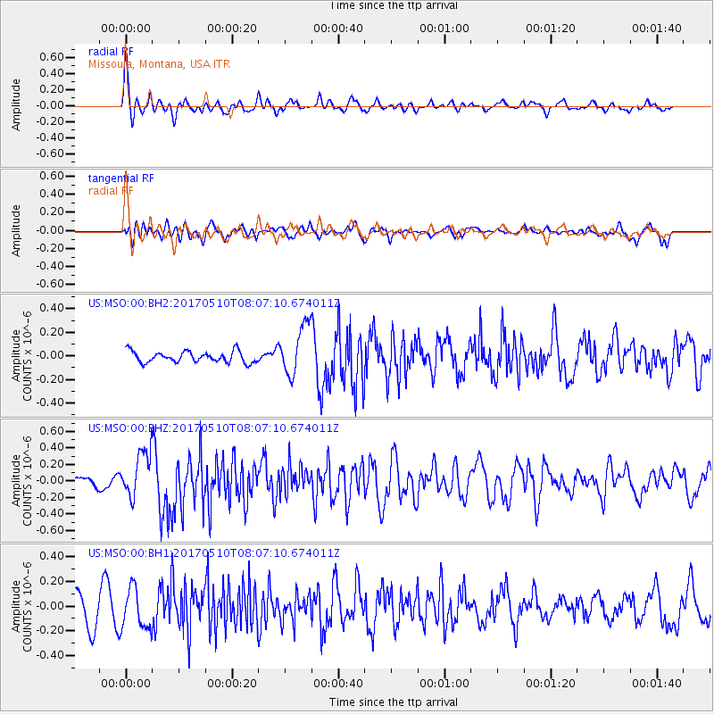
MSO Missoula, Montana, USA - Earthquake Result Viewer
*The percent match for this event was below the threshold and hence no stack was calculated.
| Earthquake location: |
Andreanof Islands, Aleutian Is. |
| Earthquake latitude/longitude: |
51.4/-178.5 |
| Earthquake time(UTC): |
2017/05/10 (130) 07:59:55 GMT |
| Earthquake Depth: |
1.0 km |
| Earthquake Magnitude: |
6.0 Mi |
| Earthquake Catalog/Contributor: |
NEIC PDE/at |
|
| Network: |
US United States National Seismic Network |
| Station: |
MSO Missoula, Montana, USA |
| Lat/Lon: |
46.83 N/113.94 W |
| Elevation: |
1264 m |
|
| Distance: |
41.2 deg |
| Az: |
70.073 deg |
| Baz: |
301.019 deg |
| Ray Param: |
$rayparam |
*The percent match for this event was below the threshold and hence was not used in the summary stack. |
|
| Radial Match: |
70.14175 % |
| Radial Bump: |
398 |
| Transverse Match: |
59.861755 % |
| Transverse Bump: |
400 |
| SOD ConfigId: |
2028011 |
| Insert Time: |
2017-05-24 08:05:34.060 +0000 |
| GWidth: |
2.5 |
| Max Bumps: |
400 |
| Tol: |
0.001 |
|
Signal To Noise
| Channel | StoN | STA | LTA |
| US:MSO:00:BHZ:20170510T08:07:10.674011Z | 3.4847167 | 2.803198E-7 | 8.044264E-8 |
| US:MSO:00:BH1:20170510T08:07:10.674011Z | 1.2388263 | 1.6344663E-7 | 1.3193669E-7 |
| US:MSO:00:BH2:20170510T08:07:10.674011Z | 4.591047 | 2.139829E-7 | 4.660874E-8 |
| Arrivals |
| Ps | |
| PpPs | |
| PsPs/PpSs | |


