You are here: Home > Network List > WY - Yellowstone Wyoming Seismic Network Stations List
> Station YPP Pitchstone Plateau, YNP, WY, USA > Earthquake Result Viewer
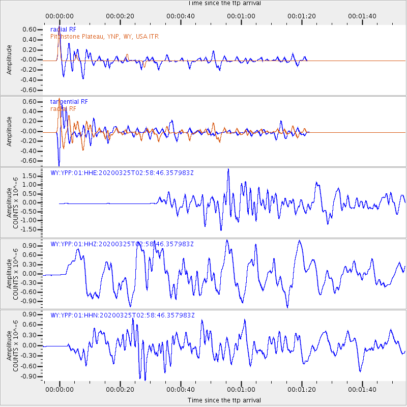
YPP Pitchstone Plateau, YNP, WY, USA - Earthquake Result Viewer
*The percent match for this event was below the threshold and hence no stack was calculated.
| Earthquake location: |
East Of Kuril Islands |
| Earthquake latitude/longitude: |
49.0/157.7 |
| Earthquake time(UTC): |
2020/03/25 (085) 02:49:21 GMT |
| Earthquake Depth: |
57 km |
| Earthquake Magnitude: |
7.5 Mww |
| Earthquake Catalog/Contributor: |
NEIC PDE/us |
|
| Network: |
WY Yellowstone Wyoming Seismic Network |
| Station: |
YPP Pitchstone Plateau, YNP, WY, USA |
| Lat/Lon: |
44.27 N/110.80 W |
| Elevation: |
2707 m |
|
| Distance: |
59.3 deg |
| Az: |
56.661 deg |
| Baz: |
309.997 deg |
| Ray Param: |
$rayparam |
*The percent match for this event was below the threshold and hence was not used in the summary stack. |
|
| Radial Match: |
86.585014 % |
| Radial Bump: |
400 |
| Transverse Match: |
76.79292 % |
| Transverse Bump: |
400 |
| SOD ConfigId: |
20906531 |
| Insert Time: |
2020-04-08 15:25:53.343 +0000 |
| GWidth: |
2.5 |
| Max Bumps: |
400 |
| Tol: |
0.001 |
|
Signal To Noise
| Channel | StoN | STA | LTA |
| WY:YPP:01:HHZ:20200325T02:58:46.357983Z | 45.173275 | 2.3838156E-7 | 5.2770486E-9 |
| WY:YPP:01:HHN:20200325T02:58:46.357983Z | 10.605468 | 4.4362853E-8 | 4.183017E-9 |
| WY:YPP:01:HHE:20200325T02:58:46.357983Z | 22.36174 | 1.3498813E-7 | 6.0365664E-9 |
| Arrivals |
| Ps | |
| PpPs | |
| PsPs/PpSs | |


